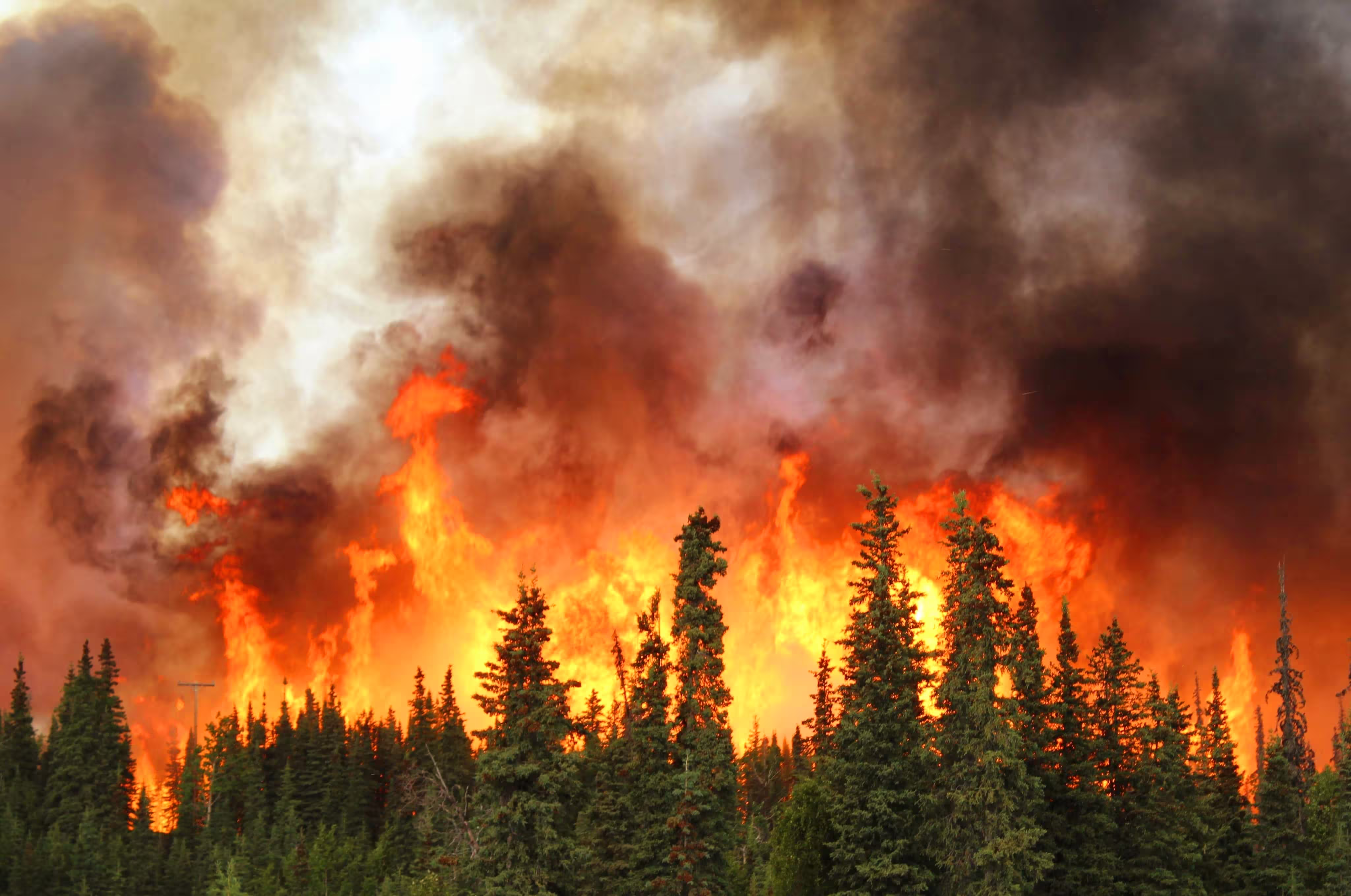

When the fire is 10 km out: how Lac du Bonnet turned wildfire risk into a plan
After the 2025 Wendigo Fire, the Rural Municipality and Town of Lac du Bonnet asked Forsite to show them where wildfire risk is highest and what to do about it. They now have 13 ranked priority areas, evacuation triggers tied to street names and landmarks, and 71 actions with a lead agency attached to each.
Introduction
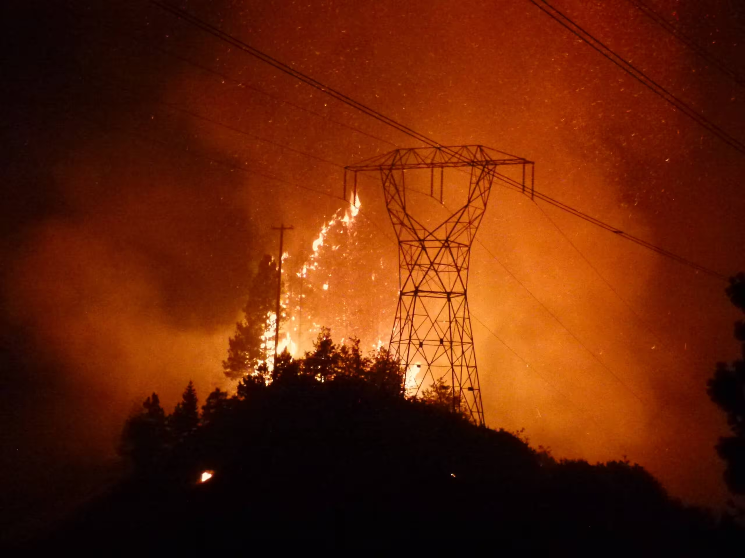
The 2025 Wendigo Fire took 28 homes and the lives of two Lac du Bonnet residents. For a municipal fire department responsible for 6,169 structures across a boreal land base, it turned a long-standing question into an urgent one: when the next fire starts, where do we put our people and our money first?
The Lac du Bonnet Fire Department brought that question to Forsite. The department asked for two things: a ranking of the highest-risk areas, so mitigation resources could go where they would do the most good, and practical guidance on prevention, mitigation and emergency preparedness.
The Challenge
Canada has seen fire behavior in recent years that few communities planned for. Lac du Bonnet sits in the middle of that reality. The Rural Municipality holds large areas of forested land inside its boundaries, where continuous coniferous fuel raises the risk of long-range ember spread.
The department's resources are finite, and the land base is not. Without a clear picture of where exposure and consequence overlap, every neighborhood looks like a priority, and none gets the attention it needs.
The community also needed more than a map. Prevention, mitigation and emergency response involve the municipality, the province, Manitoba Hydro and residents. A useful plan had to say who does what, not only where the risk sits.
What we did
Listening first
Kyle Gillich, Forsite's Technical Lead for Wildfire Risk, brings 20 years of fire management and planning experience. He started by meeting with the Lac du Bonnet Fire Department and Emergency Coordinator John Fleming to understand how they work and where their gaps were.
The circle widened from there. Kyle and the team engaged the Forestry Branch, Manitoba Wildfire Service, the Office of the Fire Commissioner, Manitoba Hydro, community FireSmart champions, and residents who lived through the Wendigo Fire.
Building the picture
Forsite's wildfire data analysts then modeled the landscape layer by layer:
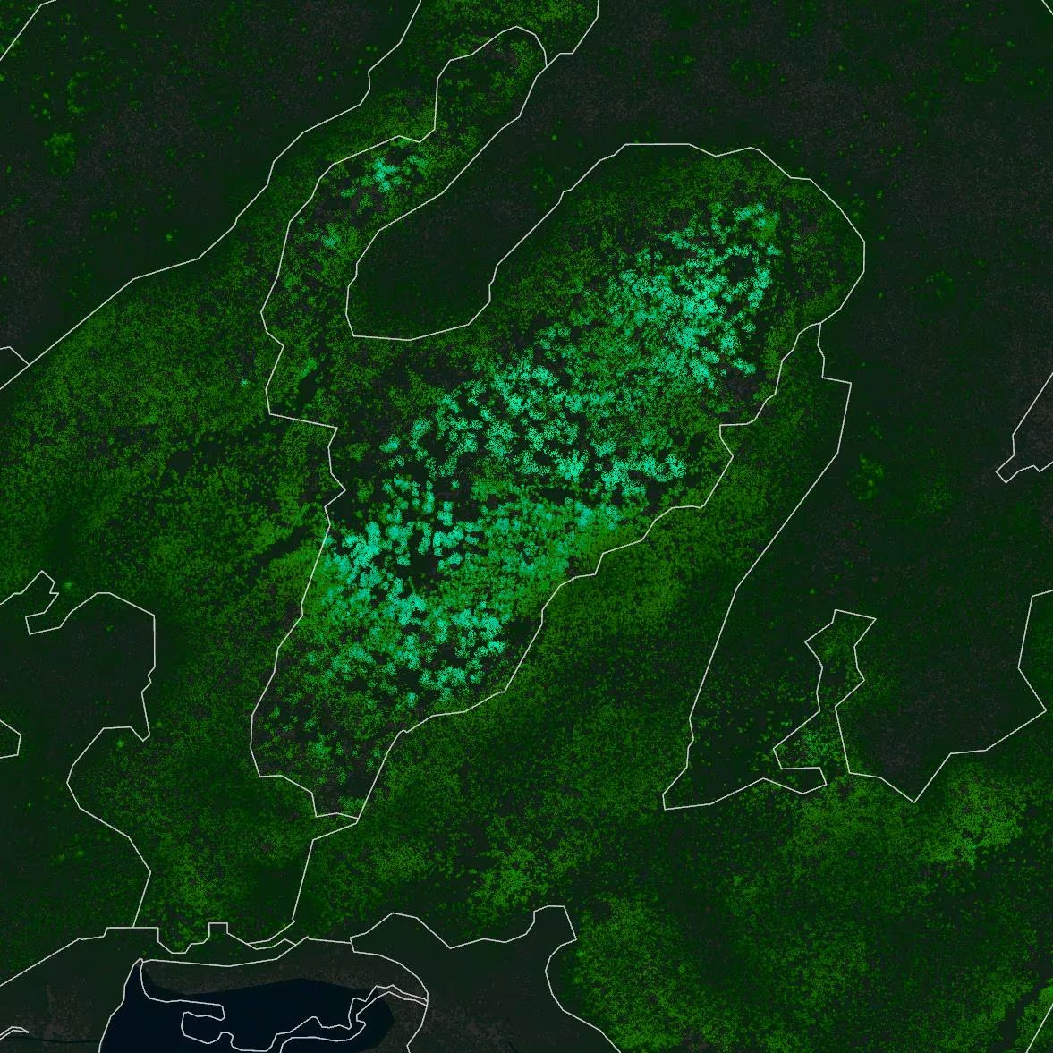
- Fuel types at 30 m. Natural Resources Canada's 2024 fire behaviour prediction (FBP) fuel grid served as the baseline, updated for recent disturbance, fire severity and crop type, then field-validated across the priority areas.
- Fire exposure at 500 m. Landscape and fuel-to-fuel exposure was calculated on a 0.1 ha hexagonal grid. The fuel-to-fuel method was developed by Forsite's Nima Karimi, PhD, and Patrick Mahler, MSc, with support from Jen Beverly, PhD, at the University of Alberta.
- Susceptibility. Building exposure load, or building density, was run against fire exposure to find where the greatest threat to buildings sits.
- Likelihood. An analysis of historical weather and fire perimeters provides insight to the likelihood of fire events.
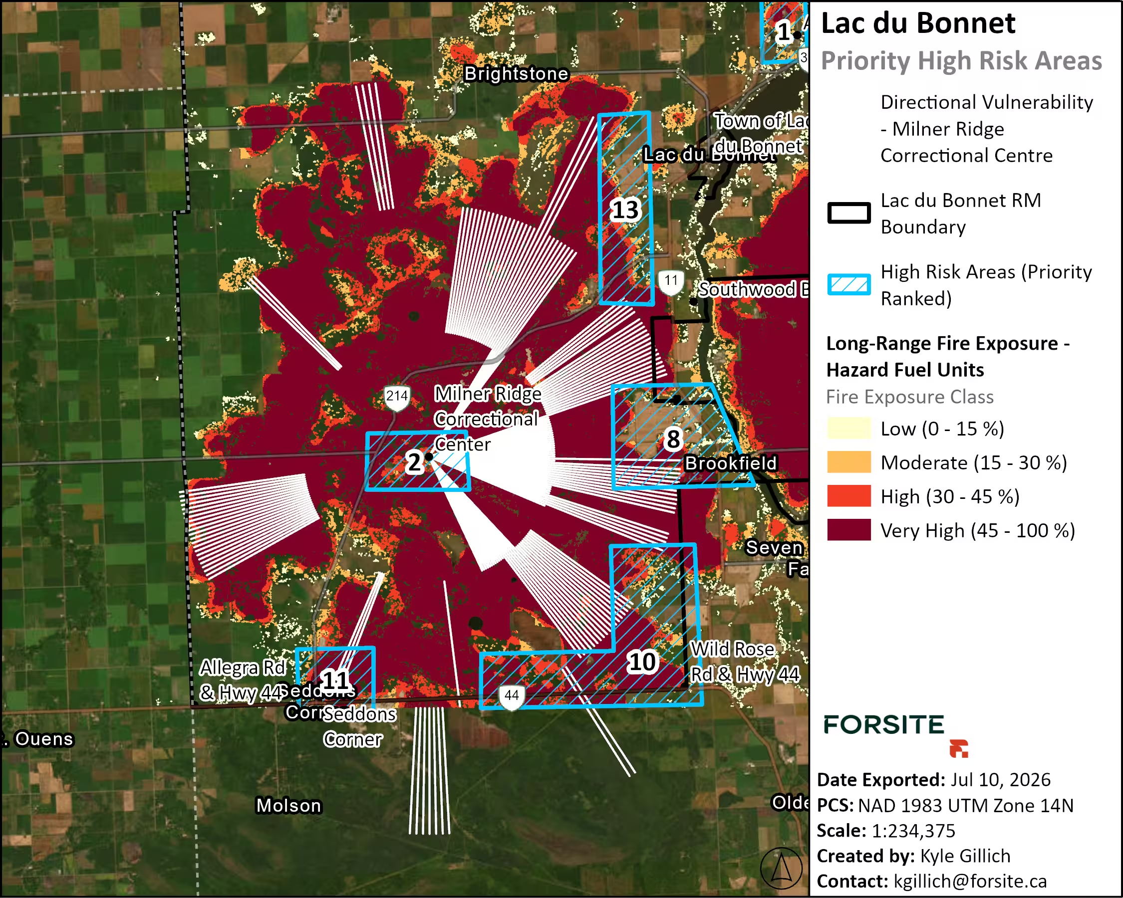
- Directional vulnerability. Fire paths were traced toward critical infrastructure from every direction: 360 trajectories at 1° intervals, reaching 15 km out.
- Time to impact. Eight-hour spread envelopes were run for each fire danger class across the highest-ranked areas, turning distance into an evacuation trigger.
- Magnitude. Fire behavior outputs were modeled: rate of spread, head fire intensity and crown fraction burned.
Working on the ground
The team verified model inputs in the field, presented findings to the Reeve and Council, and hosted a public Open House so residents could see the final report and ask questions directly.
The Outcomes
Lac du Bonnet now has a ranked, mapped and assigned plan for reducing wildfire risk. Here is what the department and council walked away with.
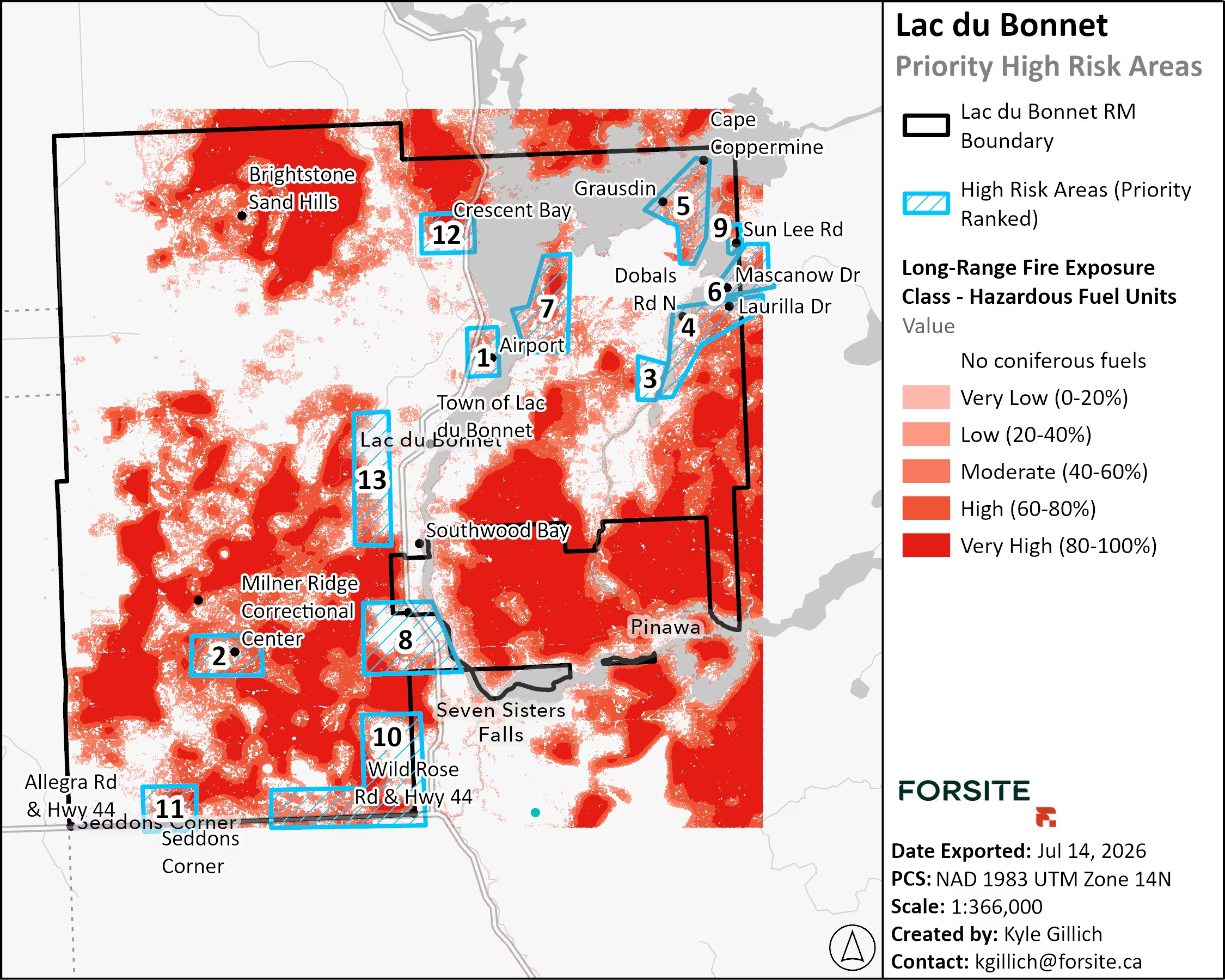
13 priority areas, ranked
Each area is ranked on fire exposure, building density and consequence. Forty percent of the land base falls in high or very high long-range exposure, along with $478 million in assessed property. The ranking tells the department where to start.
Evacuation triggers crews can call by name
Distance-based triggers are written in kilometers and tied to street names and landmarks. At one critical facility, for example, a fire 1.5 km away can reach fuel at the facility within eight hours under moderate fire danger. On a worst-case day, that same eight-hour window opens when the fire is still 10 km out.
Treatment units ready for prescriptions
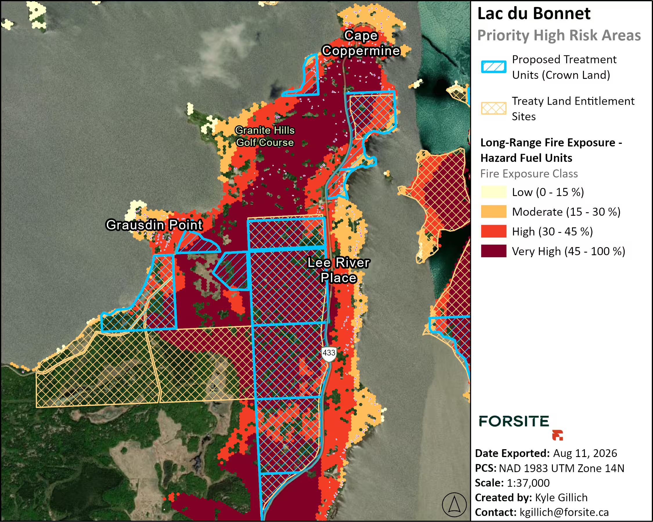
Crown and municipal parcels are mapped against fire exposure, with Crown land and Treaty Land Entitlement sites shown. Treatment polygons are drawn and ready for site-level fuel-management prescriptions.
71 actions, each with an owner
The actions span the seven FireSmart disciplines. Each carries a priority rating, a lead agency and the resources required. Twenty-five need provincial participation, and together they form a five-to-ten-year plan to establish FireSmart and fuel-management programs.
Data the department keeps
A webmap and full spatial dataset include the updated fuel layer, values at risk, every modeled output and the proposed treatment areas. Together, they give the municipality a working base for grant applications, council decisions and incident planning.
"The final product is a document that will enable our municipality to build a wildfire strategy into the future based on the collection of scientific data and field observations."
- John Fleming, Emergency Coordinator, Lac du Bonnet
What's next for Lac du Bonnet
The plan runs five to ten years, and the first priorities are already set. The department knows which 13 areas come first, which agency leads each action, and when to call an evacuation based on how far the fire is and how the day is burning.
Planning for wildfire in your community? Forsite's Wildfire Risk Services team works with municipalities, fire departments and emergency managers to turn fire risk into a ranked, practical plan.
FAQ
#1: Where should we focus wildfire risk mitigation efforts with FireSmart initiatives, fuel management and prescribed fire?
It’s important to start with a foundation of a quality Hazard & Risk Assessment to assess where to prioritize prevention and mitigation initiatives. Forsite’s risk assessments align with the Canadian Council of Forest Ministers (CCFM) Canadian Wildland Fire Risk Assessment Framework. We assess the magnitude of potential fire behavior with fire spread modeling, exposure of long-range ember transmission and proximity of fuels, susceptibility of values at risk including building density and vulnerabilities, and likelihood of wildfire events with potential consequences. We pair risk assessments with Wildfire Mitigation Strategies that include recommendations under each of the seven (7) FireSmart disciplines, including FireSmart education for landowners and vegetation management for the broader landscape. Our wildfire risk management specialists carefully assess the results of the risk assessment to delineate priority areas for mitigation and at-risk neighborhoods that would benefit from FireSmart initiatives.
#2: How can we implement mitigation treatments and actually see some change?
A well-done Wildfire Mitigation Strategy provides clients with a roadmap through successful initiatives. It is important to follow the plans that are based in science and professional experience. Municipalities should focus on priority areas identified in the risk assessment, and develop site-level plans or prescriptions that define expectations for post-treatment targets. Engaging with partners and stakeholders is the key to successful mitigation initiatives, whether sourcing funding, delineating the boundaries, or satisfying as many land-use objectives as possible simultaneously. Fire knows no boundaries, so mitigation requires planning across multiple jurisdictions, with land managers and multiple agencies (e.g., provincial Forestry Branch, Manitoba Wildfire Service, and Manitoba Hydro). If municipal staff don’t have the capacity or knowledge to champion a risk reduction program, Forsite has very experienced staff to help with full-service risk reduction programs.
#3: What planning comes after a risk assessment and mitigation strategy?
A risk assessment and mitigation strategy cover the first phase of wildfire risk management. Forsite supports clients through all four phases of the emergency management cycle: prevention, preparedness, response and recovery.
- Prevention and mitigation: Resiliency planning, FireSmart initiatives and fuel treatments that reduce risk before a fire starts. Your risk assessment and mitigation strategy set the priorities for this work.
- Preparedness: Usually the next step. It includes evacuation planning, equipment, training and operational plans such as Wildfire Preparedness Guides and Structure Protection Plans.
- Response: Wildfire monitoring and predictive services that support operational decisions while a fire is burning.
- Recovery: Often overlooked, but best planned before a fire happens. A recovery plan sets out roles and responsibilities, salvage timber harvesting and rehabilitation, so recovery can start quickly and safely.