.svg)
Governments
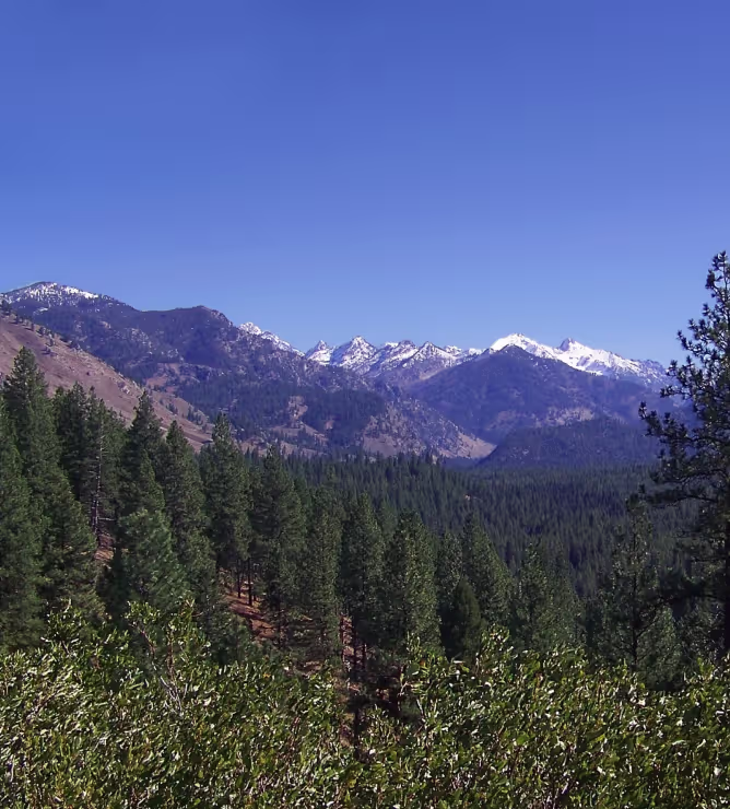
Forest and Landscape Stewardship, Management, and Wildfire Resilience Planning for All Levels of Government
Forsite supports all levels of government from high-level strategic forest landscape planning down to community level wildfire resiliency plans and community forest management. We offer high-resolution geospatial data products to support effective planning and work alongside your team from planning through delivery.
Proven in the Field
Landscape to Community‑Scale Impact and Funding Alignment
Forsite's strategic forest and wildfire planners and analysts, community programs and geospatial data products and solutions help all levels of government clients unlock funding, guide project delivery, and build long-term resilience.
9
Forest landscape plan facilitated
180
Community wildfire plans delivered
20
Community Forests supported
56
Fuel ID layers + behavior simulations
.svg)
KEY product FEATURES
Key Service Areas - What our Specialists Deliver
Inventory building blocks that reduce uncertainty and cost.
Science‑driven strategies, on‑the‑ground expertise, and a collaborative and values‑driven approach for resilient forests, communities, and ecosystems.
Forsite supports clients across North America with integrated forest stewardship solutions that balance ecological integrity, economic objectives, regulatory requirements, and community values — recognizing the deep relationships that Indigenous Nations, communities, and rights holders maintain with their territories. Our teams combine advanced data, modeling, and field expertise to guide long‑term, defensible decision‑making.
We support:
Integrated land‑use and cumulative‑effects planning
Governance and program development for community forests
GIS, mapping, and aanalysis
Best management practices
Forest landscape planning
Visual resource management (VRM)
Integrated Resource Management Plans (IRMPs)
Stakeholder, community, and public engagement support
Forest Management Plans (FMP)
Economic and timber/land valuation analysis
Forest landscape modeling and scenario analysis for carbon, climate, and harvest
Compliance and assessment support, such as climate vulnerability assessments; watershed and hydrology assessments; habitat and biodiversity assessments; and recreation, access, and cultural-use mapping
Strategic planning, defensible analysis, and policy alignment remain core components of our stewardship services.
Regulatory‑aligned planning and reporting
Climate‑risk and cumulative‑effects assessments
Visual resource management (VRM)
Governance and program development for community forests
Economic and timber/land valuation analysis
Stakeholder, community, and public engagement support
Strategic landscape plans and operational forest management plans
High density LiDAR data allows Forsite to produce detailed individual tree inventories and vegetation analysis, including:
Forest operational planning
Road layout and design
Management objectives and forest land valuation
Watershed restoration and resiliency planning
Restoration planning and project design
Cultural and prescribed burn planning
Post‑wildfire assessments
Fuels planning for wildfire mitigation
Stand assessments and invasive species mapping
Forsite provides wildfire services across the full spectrum of Wildfire Management: Prevention, Preparedness, Response, Recovery (PPRR). Our proprietary tools use remote sensing and machine learning to rapidly update fuel type maps and provide detailed vegetation characteristics to support safer, more resilient planning.
Community wildfire resilience planning
Fuel assessments & mitigation strategies
Operational wildfire support
Evacuation route planning
Fire behavior modeling and fuel mapping
Training and community education
Funding application support
Community re-entry support
Each community forest has unique needs and we work with our clients to support them in success — from strategic analysis to program implementation to field services.
Leverage government funds
Visual resource management
Land base reporting
Strategic planning and governance
Community engagement
Recreation and trails
Watershed risk management
Timber supply analysis
Web mapping and GIS data
ForestView® and Exchange™ LiDAR products
Community wildfire protection planning
Our goal is to support stand-level planning and prescription development that respects both ecological integrity and cultural values.
Wildlife habitat
Riparian areas
Ecological features
Hydrologic conditions
Roads and infrastructure
Vegetation management
Watershed risk management
Timber supply analysis
Other non-timber values
Supporting healthier, more resilient forests through targeted restoration programs.
Ecosystem restoration strategy and project planning
Cultural and prescribed burning support
Invasive species and stand‑condition mapping
Fuel treatment planning and prioritization
Post‑wildfire hazard identification and community re‑entry assessment
Qualified professionals deliver wildfire hazard assessments and reports.
Site plan reviews and field assessments
Approval-ready reports
WUI threat assessments
Forsite Exchange LiDAR Library
Geospatial data products library designed to address current and future risk by providing continuous, accurate, and actionable information
LiDAR, Remote Sensing Analysis & Derivative Products
Fire preparedness, risk, and burn severity
Forest health metrics and tree mortality
Rural and urban community safety planning
Transportation mapping
Utility risk assessments
Resource prioritization and budgeting
.png)
customers testimonials
What Our Clients Say

customers testimonials
What Our Clients Say
Forsite has been a valuable partner to the McLeod Lake Indian Band, providing the expertise and dependable support that continue to strengthen both of our forestry companies, Sekani Forest Products and Tse’Khene Timber which fosters our Nation’s long term economic well being. Their consistent, high quality forest planning helps us meet volume requirements across a diverse range of licences, supporting steady operations and informed, responsible decision making on the land base. Forsite’s professionalism, responsiveness, and collaborative approach have directly contributed to our community’s economic prosperity, ensuring our values, sustainability, and opportunity remain at the forefront. We are grateful for their ongoing support and look forward to many more years of strong partnership.
read moreFrequently Asked Questions
Do you follow the current CWRP template in Canada?
Yes, plans follow the 2024 BC template and instruction guide where applicable.
.avif)
Ready to Enhance Stewardship and Resilience?
Let’s discuss how we can support your programs.