.svg)
Pipeline Patrol
DOT-Compliant Pipeline Patrol with Aerial Intelligence and Real-Time Reporting
Weekly DOT-compliant patrols backed by real-time reporting to field crews, ESRI-integrated oriented imagery, and a compliance app that turns every flight into audit-ready evidence.

why organizations trust us
Unmatched Safety, Scale, and Intelligence
We pair decades of industry-leading patrol operations with our proprietary ESRI-integrated patrol cameras, enabling customers to capture imagery of every moment of a standard visual patrol — and app workflows to deliver proof-of-patrol and faster issue resolution.
Benefits
Meet DOT mandates with documented proof-of-patrol and oriented imagery
See more with oblique images that auto-track the ROW centerline
Act faster with real-time encroachment locations shared to crews
Augment with LiDAR and nadir imagery for geohazard and erosion monitoring
why organizations trust us
Proof: The Patrol Program Operators Rely On
Our scale and technology deliver coverage, consistency, and audit-readiness for operators across the U.S.
85
years
Continuous experience since 1940
2.2M
Miles per year
Of ROW patrolled with 20,000+ flight hours annually
70
customers
Served with onshore and offshore patrols
22
locations
Supporting nationwide coverage
.svg)
Safety-First Operations and Nationwide Capacity
A first-class fleet, expert crews, and superior maintenance underpin consistent, safe patrols across complex airspace and terrain.
Experienced pilots and observers and Safety Management System (SMS)
22 aircraft bases and maintenance facilities for rapid response
Flexible scheduling to accommodate weather and customer emergencies
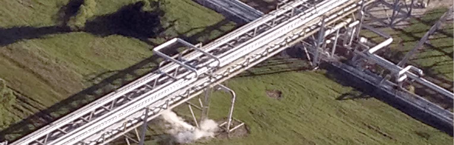
PatrolView™ Imagery and App for Actionable Patrols
Oblique imagery and ESRI-integrated app capture every moment, geotag encroachments, and streamline field response.
Roll-stabilized, FAA-approved pod tracks the centerline while capturing continuous oriented imagery
22 aircraft bases and maintenance facilities for rapid response
AI models to flag changes along the ROW
Learn more about PatrolView™
Key Features and Benefits
Compliance, context, and speed of response in one program.
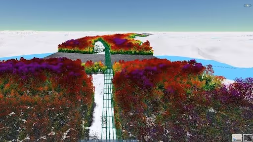
LiDAR Operations for Supplementary Enhanced Risk Intelligence
.png)
Pipeline Geohazards
LiDAR collection for ground movement detection, erosion monitoring, and landslide risk assessment. Multi-year DEM comparison tracks subsidence and terrain change over time, pairing with weekly aerial patrol imagery for continuous ROW integrity monitoring.
Vegetation Analytics and Work Planning
LiDAR-derived individual tree inventory with density and risk scoring, fed into an optimization solver that runs hundreds of thousands of simulations to determine the optimal multi-year clearing schedule — accounting for species-specific growth rates, terrain, contractor mobilization, and regulatory requirements. Built by experienced vegetation managers, this program automates the decision-making that traditionally requires large teams, enabling small crews to manage massive ROW vegetation programs at scale and delivering operators a consistent annual return on investment.
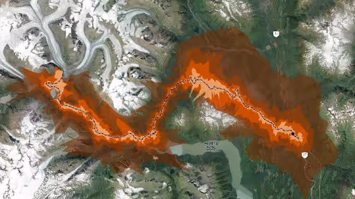
Wildfire Modeling
Predictive wildfire risk modeling extended from our industry-leading forestry and utility wildfire programs — now applied to pipeline corridors to protect assets, inform operational decisions during fire seasons, and support regulatory compliance.
Improve worker health and safety
Minimize risk to assets and infrastructure from wildfires
Comply with federal and provincial legislation
Social licensing
Frequently Asked Questions
How often do you patrol?
We follow DOT requirements and tailor cadence by segment and risk profile
Can you integrate with our GIS?
Yes, data and imagery integrate with ESRI OIC and your GIS layers.
Do you offer offshore patrols?
Yes, we support both onshore and offshore operations along the southern North American coast.
.avif)
Ready to See the Full Picture?
Forsite brings together aerial sensors, geospatial analytics, and on-the-ground — one integrated team, from first acquisition to final decision. Let's talk about what that looks like for your operation.
%20(1)%20(1).png)
Ready to Modernize Your Patrol Program?
Let's align cadence, sensors, and reporting to your assets and risk profile.