.svg)
Wildland Fire — Services and Operational Expertise
International Leaders in Wildland Fire Solutions
Our wildland fire services combine operationally experienced fire specialists including planners, analysts, modelers, and operational responders.

why organizations trust us
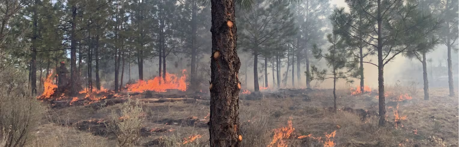
Community-Scale Wildfire Risk Reduction Driven by Operational Experience
Community Wildfire Resiliency services translate operational wildfire expertise and analytics into on-the-ground planning, wildfire exposure risk reduction, and preparedness. Our team supports communities, Indigenous Nations, and forestland managers in creating operationally feasible plans and prescriptions that aim to reduce expected fire behavior, improve ingress/egress, and contribute to defensible space. Our objectives are to promote human safety, preserve valued places, and protect homes and property.
Benefits
Community resilience planning — CWPPs, CWRPs and FireSmart (CAN), fuels management prescriptions, prescribed burn planning — and funding support
High-resolution fuels mapping and wildfire behavior modeling for targeted mitigation — powered by FireViewTM
Prescribed burn planning, fuels management prescriptions and implementation monitoring, and post-fire recovery planning
Utility wildfire risk analytics and mitigation planning, as well as operational awareness tools offered through RiskViewTM
FireView™ Analytics, Fuels Mapping, and Modeling for Targeted Mitigation
FireViewTM turns weather data, fuels, terrain, and ignition patterns into wildfire intelligence you can act on. From fire forecasting and burn probability to exposure and scenario modeling, FireViewTM provides landscape-scale analytics that help communities, utilities, and land managers plan, prioritize and operate with confidence.
Higher-resolution fuels and faster updates
Landscape-scale simulations and projections of different management scenario outcomes
Integrated with permitting, resilience planning, and operations
Core Community Wildfire Resiliency
and Risk Mitigation Services
A complete toolkit from planning to operations — tailored to your risk environment.
Core FireView™ Analytics Services
Wildfire intelligence for planning, exposure, and operations.
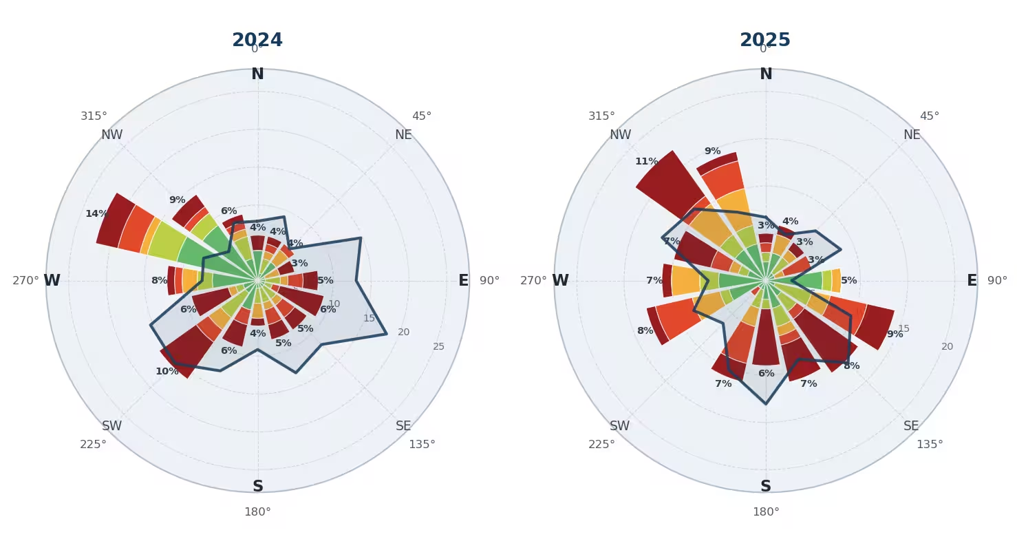
Weather Intelligence — Historical and Trends
Historical weather analysis — wind roses and FWI/ISI roses by season and location
Weather trend analysis — FWI/FFMC trends to reveal changing risk profiles
Reanalysis-grade weather data for consistent comparisons
Wildfire Forecasting — PYrocell, FlamMap, WISE, and others
Regionally flexible forecasting engines
Fire spread forecasting based on fuel-wind-moisture inputs
Supports planning, operations, and mitigation design
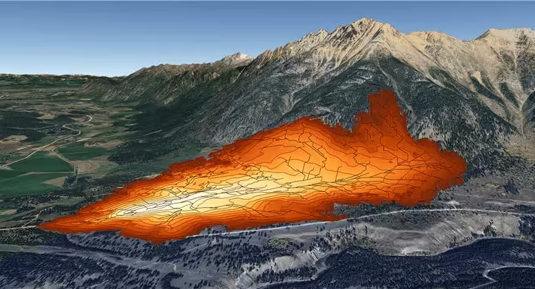
Burn Probability and Ignition Analytics
Burn probability modeling prep — seasonality, ignition distributions, fuels, and wind grids
Wildfire modelling — continuous surface
Gridded and Randomized modeling — BurnP3-style ensembles
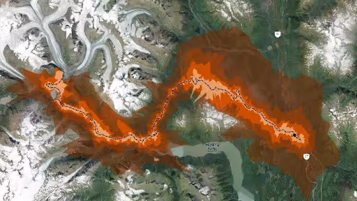
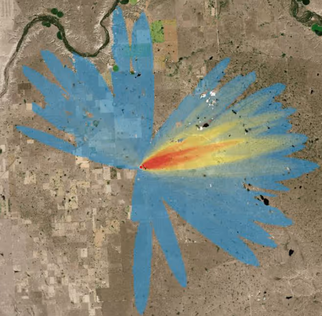
Exposure Analysis and ROS Distance
Directional exposure for communities and assets
Building exposure and fireline exposure (FE)
ROS Distance Analysis — time and distance envelopes
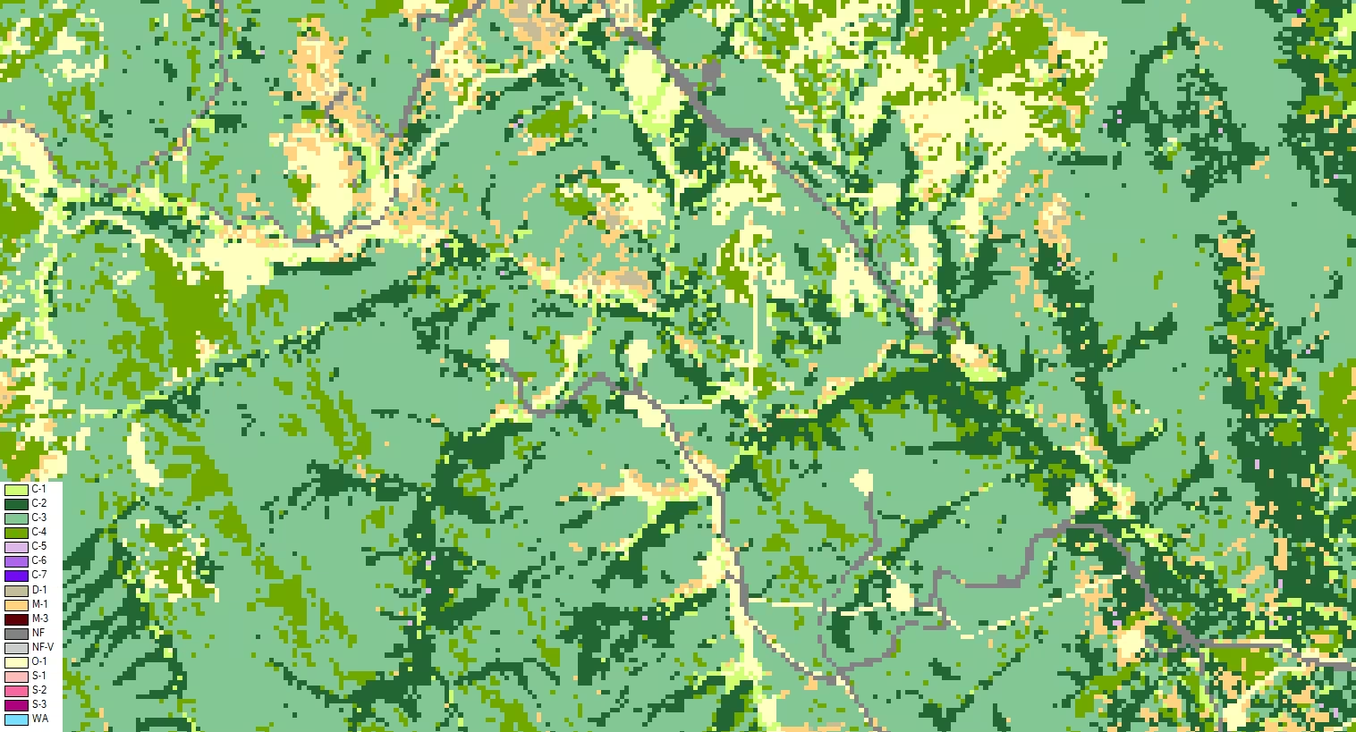
Fuels Intelligence
Fuel ID vs fuels updates
Fuel ID — full pipeline: 56+ canopy, mid-story, and surface characteristics
Fuels updates — quicker remote-sensing-driven refresh
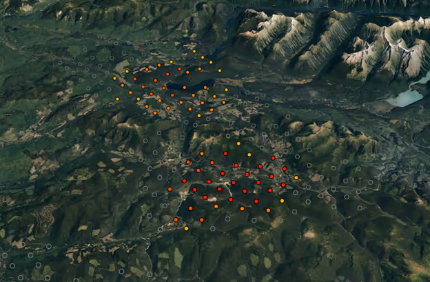
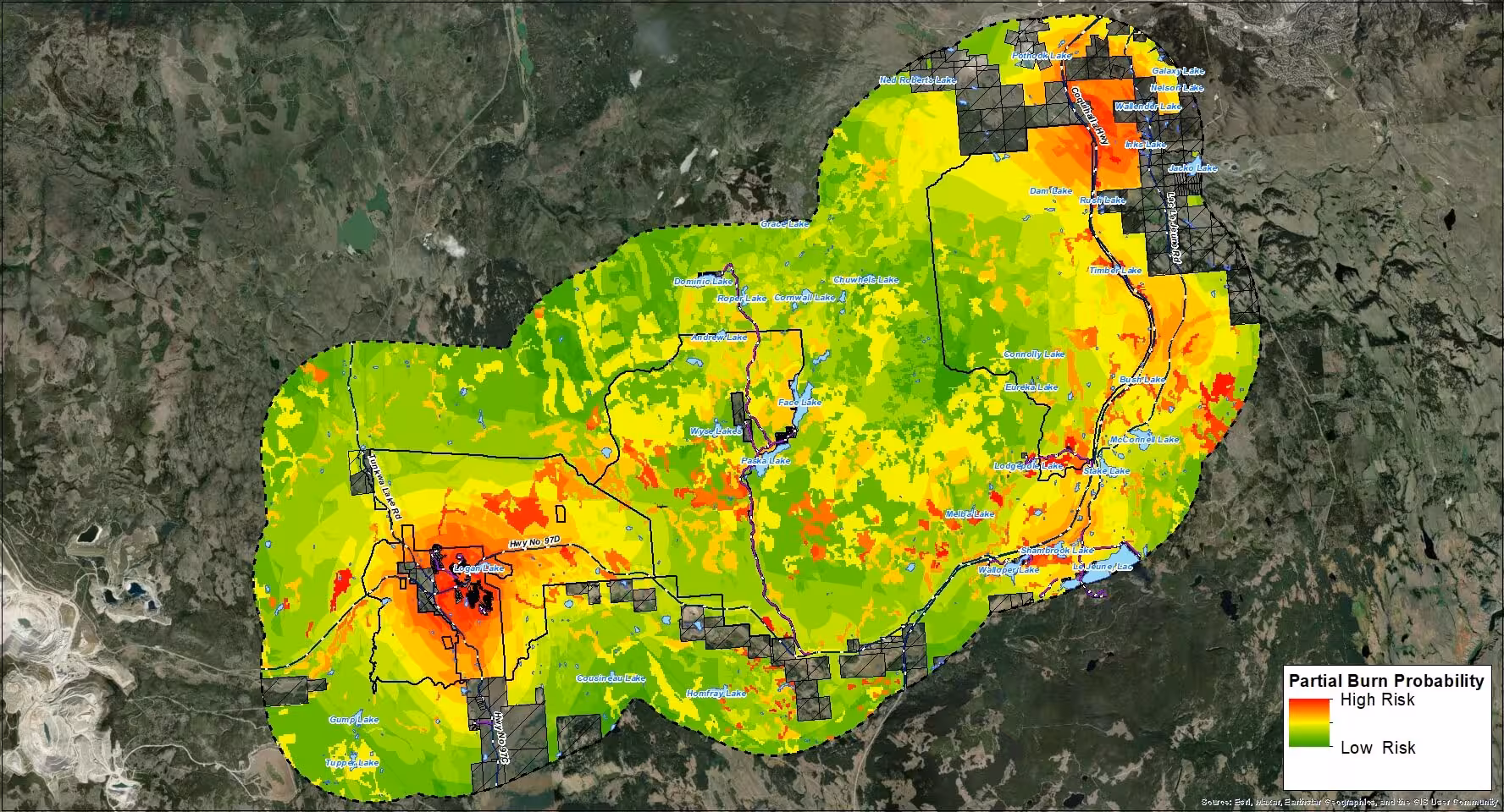
Risk and Prioritization Layers
Ignition threat mapping — kernels or prep-tool
Fire shed mapping
Risk to assets — exposure plus consequence
Scenario Modelling and Mitigation Treatments
Scenario comparisons across weather windows
Treatment design and before-and-after deltas
why organizations across north america trust us
Actionable Insights and Protection Plans for Communities and Infrastructure
Our team draws upon their on-the-ground fire experience, professional expertise and credentials to provide sound advice and solutions to clients seeking to increase their resilience to wildfire.
56
Fuel characteristics modelled from LiDAR and satellite data
30 metre
High resolution Canadian FBP fuel maps produced for AB, BC, SK provinces in Canada (10 metre where available)
180
Plans for community-level wildfire resilience and education delivered
Services in 8 Provinces/Territories and 5 States
WA, OR, ID, MT, and AZ: Leveraging of full Digital Inventory data as model inputs within the US west for public and private landscape projections
Right-of-Way
Fire management planning for utilities and critical infrastructure
Frequently Asked Questions
What is Fuel ID?
Fuel characteristics modeled from LiDAR and satellite data to produce detailed fuel attributes maps.
Can you help with permits?
Yes, we prepare wildfire hazard assessments and reports for development permit applications.
Do you run fire behavior simulations?
Yes - PYroCell, W.I.S.E, Prometheus and BURN-P3, and US models including FlamMap, Behave, and WRF-Fire.
Do you support utilities?
Yes, we build risk plans, situational awareness tools, and ROW fire management.
Can you support Permitting?
Yes, development permit wildfire hazard assessments are part of FireView™ service.
.avif)
Ready to Reduce Wildfire Risk?
We'll align fuels, modeling, and operations to your objectives and constraints.