.avif)
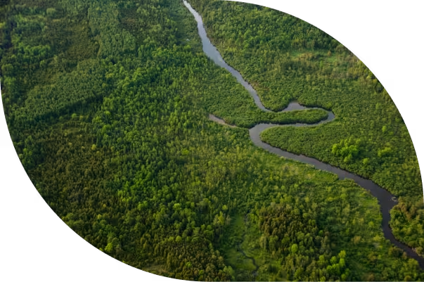
Geospatial Solutions for Energy
Infrastructure, Natural Landscapes and Wildfire Protection
Forsite brings together aerial LiDAR, pipeline patrol, wildfire science, and professional forestry under one roof — giving operators across North America a single, credentialed partner for the complete intelligence picture their decisions depend on.
Trusted by industry leaders across North America


The Entire Picture
With 85+ years of pipeline patrol expertise and North America's largest independent aerial LiDAR library, Forsite brings proven depth across five integrated disciplines: aerial data collection, wildfire science, professional forestry, pipeline patrol, and environmental planning. That breadth, combined with advanced technology and machine learning, gives our clients something no single-discipline provider can: a complete intelligence picture, turning insight into action where it matters most.
Reduced operational, vegetation, and wildfire risk across your asset portfolio
Compliance-ready data and reporting built to withstand regulatory scrutiny
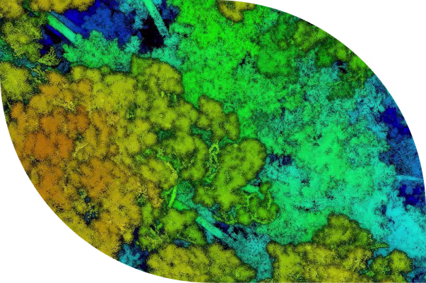
High-accuracy forest and terrain intelligence via LiDAR, spectral data, and machine learning
Proven in the Field
The Scale to Back It Up
Our operational footprint, technology breadth, and experience create unmatched confidence in planning and risk reduction.
1.9M
sq mi
High-density LiDAR collected across North America
2.2M
Miles per year
DOT pipeline right-of-way patrols conducted annually
56
Fuel characteristics
FireView™ fuel-layer modeling attributes for wildfire analytics
100M
Hectares
Over 100 million hectares (250 million acres) of forest analyzed across North America –ForestView® natural landscape resource inventories and analytics
85
Years
Aerial patrol and pipeline inspection heritage in North America


WHO WE SERVE
Built for the Organizations Who Can't Afford to Get It Wrong
We serve critical infrastructure operators, land managers, government agencies, insurers, and natural-resource industries: organizations where inaccurate data, missed threats, and delayed intelligence carry real consequences.
services & solutions
What We Do
Five integrated service disciplines. One coordinated team.
Pipeline Patrol
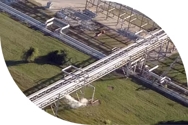
DOT-compliant aerial patrols with oriented imagery capture and AI threat detection. Encroachment detection, compliance documentation, and geohazard monitoring for pipeline and ROW (Right-of-Way) operators.
Learn more
LiDAR & Imagery
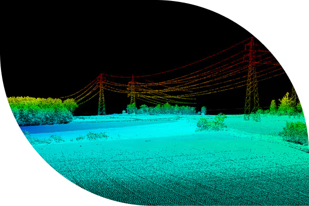
High-density and custom airborne LiDAR acquisition, 4-band imagery, and co-collection programs: processed, validated, and delivered in GIS-ready formats.
Learn more
Forestry
Field operations, full-phase reforestation and stand establishment, forest inventory, analytics, strategic planning, and long-term stewardship services across Canada and the U.S.
Learn more
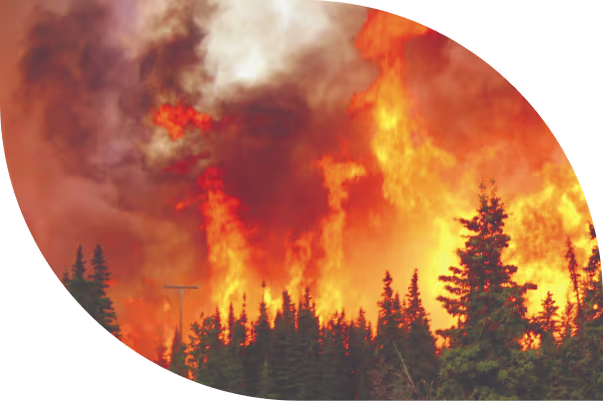
Wildland Fire
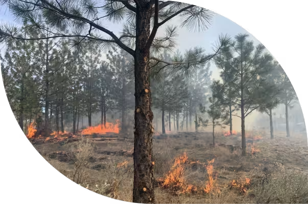
Community wildfire resiliency planning, LiDAR-based fuels mapping, fire behavior modeling, community wildfire resiliency plan development, and post-wildfire assessment, recovery and ecological restoration.
Learn more
Utilities Monitoring
Vegetation analytics, fuel load, species inventory, encroachment risk scoring, and corridor mapping for utility transmission and distribution asset managers.
Learn more
PatrolView
Integrated pipeline patrol, imagery app, and LiDAR change detection, structured for compliance and built for rapid anomaly response.
- Proof-of-patrol via ESRI Oriented Imagery Catalog integration
- Encroachment and third-party threat detection
- Geohazard monitoring via LiDAR terrain change analysis
Explore PatrolView
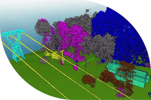
ForestView®
LiDAR-powered digital forest inventory products, from individual tree metrics to landscape-level planning intelligence.
- Tree-level and stand-level metrics: species, height, crown width, diameter, and volume.
- Growth and yield modeling for silviculture and forest carbon insights
- Planning-ready polygon inventory products compatible with standard GIS platforms
Explore ForestView®
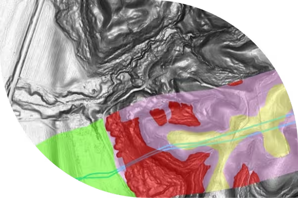
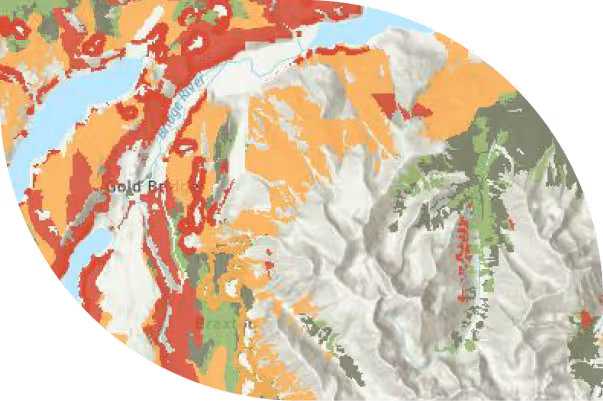
FireView®
High-resolution, seasonal fuels intelligence combined with validated wildfire behavior modeling for communities, utilities, government agencies, and insurers that need to understand fire risk before it arrives.
- High-resolution fuels mapping with 56+ fuel characteristics
- Fire spread simulations using Prometheus, BURN-P3, PYroCell, FlamMap and other validated models
- Wildfire exposure analysis for asset, community, and portfolio risk
Explore FireView®
RiskView™
A wildfire risk command center for utility vegetation management teams, combining weather, asset, and vegetation intelligence into a single operational platform.
- Dynamic daily wildfire risk scoring by span and corridor segment
- Alerts and configurable workflows for vegetation and fire risk events
- PSPS decision support with defensible, data-driven risk documentation
Explore RiskView™
.png)
customers testimonials
What Our Clients Say

Frequently Asked Questions
Do your deliverables integrate with ESRI?
Yes. Imagery is delivered through ESRI's Oriented Imagery Catalog, enabling direct integration into ArcGIS workflows. LiDAR-derived products including canopy height models (CHM), digital elevation models (DEM), and individual tree inventories are delivered in standard formats compatible with ArcGIS, QGIS, and other GIS platforms.
Do you provide wildfire behavior modeling?
Yes. FireView™ runs Prometheus, BURN-P3, PYroCell, and other validated fire behavior models to simulate fire spread, intensity, and exposure under defined weather and fuel scenarios. All modeling is conducted by FBAN (Fire Behavior Analyst) certified analysts with active fire line experience.
How accurate is your aerial LiDAR for forest inventory?
Forsite's LiDAR-based forest inventories achieve individual tree stem detection rates consistently above 90% in conifer-dominant stands. Species classification, diameter at breast height (DBH), and height estimation are validated against field measurements using peer-reviewed methodology, with published accuracy assessments in Forest Science and Remote Sensing.
Can you support a Community Wildfire Protection Plan (CWPP)?
Yes. Forsite provides end-to-end CWPP and CWRP (Community Wildfire Resiliency Plan) development including fuels assessment, risk mapping, treatment prioritization, and facilitation support. Our teams work with municipalities, Indigenous Nations, and government agencies across the U.S. and Canada.
Where do you operate?
Forsite operates across Canada and the United States. Forestry teams are based in British Columbia, Alberta, Saskatchewan, Ontario, New Brunswick, Idaho, and Washington. Aerial patrol operations run from 22+ strategic bases across the continental U.S. with LiDAR acquisition capability deployed coast to coast.
Can you respond to emergency events?
Yes. Forsite's aerial platform and GIS teams support emergency response and post-event mapping for wildfire, flood, and pipeline incidents. Our geographic distribution and fleet size enable rapid deployment to most North American locations within 24–72 hours.
.avif)
Ready to See the Full Picture?
Forsite brings together aerial sensors, geospatial analytics, and on-the-ground — one integrated team, from first acquisition to final decision. Let's talk about what that looks like for your operation.