.svg)
Utilities
Utilities — Vegetation Analytics and Wildfire Risk Operations
Utility wildfire risk demands real-time decisions. Forsite pairs high-density LiDAR and vegetation analytics with RiskView™ to prioritize spans, reduce ignition risks, and operate with confidence through fire season.
Built for Utility Operations
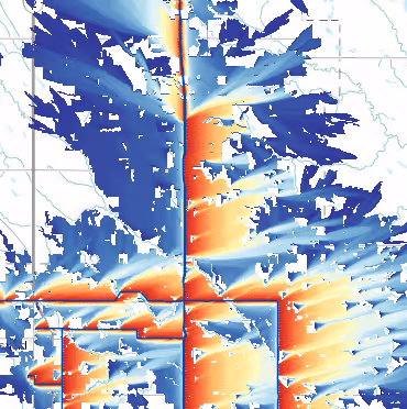
Industry-Leading Advanced Vegetation and Fire Modeling Technology
We combine vegetation and fuels analytics with weather, fire behavior, and asset data to inform vegetation management and wildfire risk mitigation decisions across O&M, EPSS, and PSPS programs.
Dynamic risk
Scoring and alerts for operations
16,000M
Miles per year
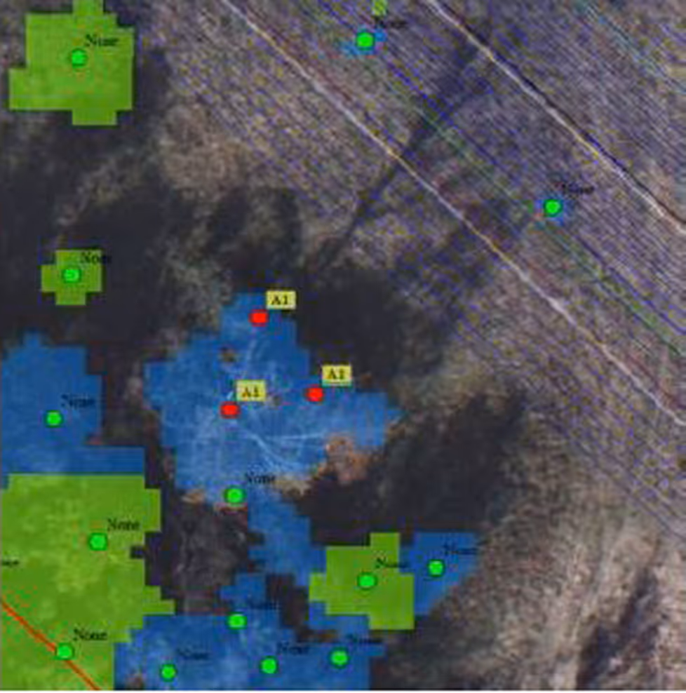
Utility line vegetation management inventory Encroachment, health, and growth
15
high resolution tools powered by FireView™ including
Wildfire behavior modeling with PYroCell, FlamMap, W.I.S.E, BurnP3+ and Prometheus
56
fuel characteristics modeled from LiDAR data .
Higher spatial resolutions than standard inventories currently used in wildfire management - up to 10m spatial resolution
INDUSTRY-LEADING ADVANCED VEGETATION AND FIRE modeling technology
Advanced Vegetation Analytics
Plan vegetation by risk and consequence using tree-level metrics and health indicators.
Intrusion codes and clearances
Fast-grower forecasting
Span prioritization
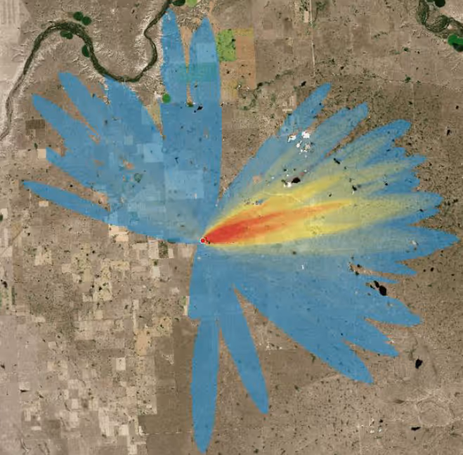
Wildfire Risk Management
Real-time situational awareness to support PSPS, crew dispatch, and operational decision making.
Wildfire Mitigation Plans and supporting analysis
Situational awareness and decision support tools
Analysis of wildfire risk both to and from utility infrastructure and operations
Blending remote sensing, LiDAR, and wildfire science
Frequently Asked Questions
Can you support PSPS workflows?
Yes, risk thresholds, alerts, decision logs, and dashboards support PSPS policy and execution.
Do you integrate with ESRI?
Yes, standard ESRI OIC and GIS integrations are supported.
.avif)
Ready to Reduce Outages and Ignition Risk?
Let's align data, models, and operations to your network.