.svg)
Forest Analytics
Forest Analytics That Turn Data into Operational Intelligence
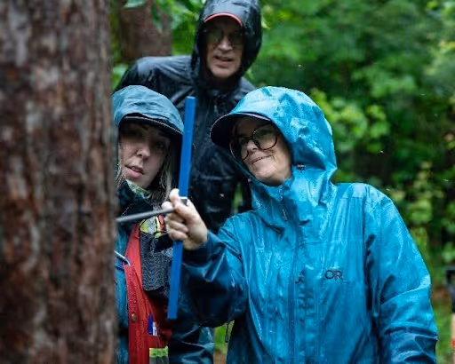
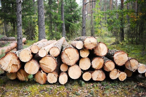
Forsite merges professional foresters, LiDAR and remote sensing specialists, and modelers to support both strategic and operational decision-making, across more than 100 million hectares of forest analyzed in North America.

why organizations trust us
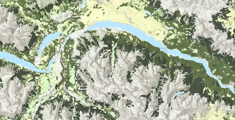
Analytics at Landscape Scale
Forsite's analytics programs have supported timber supply modeling, carbon accounting, and regulatory compliance across some of the largest forest tenures in Canada and the United States.
100M
hectares
Over 100 million hectares (250 million acres) of forest analyzed across North America – ForestView® natural landscape resource inventories and analytic.
All Land Owners
We have worked for every type of forest land manager including large and small industry, government, Indigenous Nations, communities, conservation groups, ENGOs, etc.
Models Used
Patchworks, regional G&Y models.
Core Forest Analytics Capabilities
Forsite's analytics team covers the full planning and modeling stack — from biometrics to GIS analysis to timber supply modeling and forest management plan development including climate risk assessments.
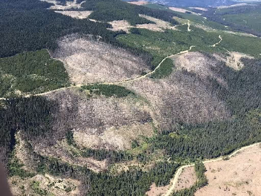
Forest Estate Modeling
We model timber and fiber supply over long planning horizons to help clients understand sustainable harvest levels and strategic tradeoffs.
Sustainable harvest scenario modeling across large landscapes
Alternative management strategy analysis: species mix, profiles, age class, haul distance, old growth, wildlife, and cumulative effects.
Optimization of harvesting and reserves considering revenues and costs to support investment decisions
Growth and Yield Modeling
We develop empirical and model‑based projections that predict stand development, productivity, and treatment impacts.
Empirical yield curves from plot data (outlier checks, curve fitting)
Application of regional growth and yield models such as TASS/TIPSY, VDYP, MGM, GYPSY, MIST, FVS, FPS, SLYM
Forecasting treatment effects and long-term stand behavior
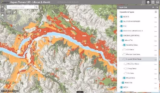
Land Base Condition Reporting
We develop empirical and model‑based projections that predict stand development, productivity, and treatment impacts.
Automated reporting for watershed disturbance levels, wildlife habitat conditions, old growth / seral conditions
Spatial assessments for planning and certification requirements
Consistent, defensible reporting aligned to regulatory expectations
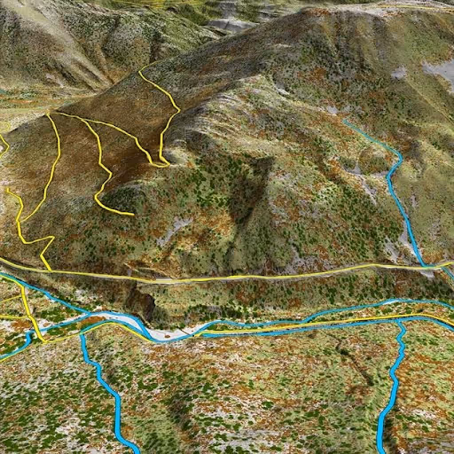
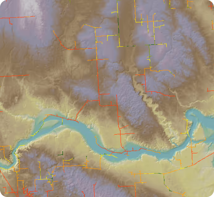
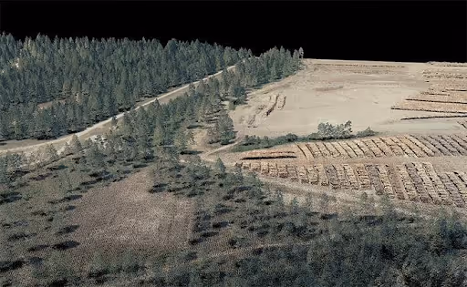
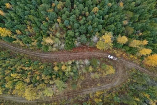
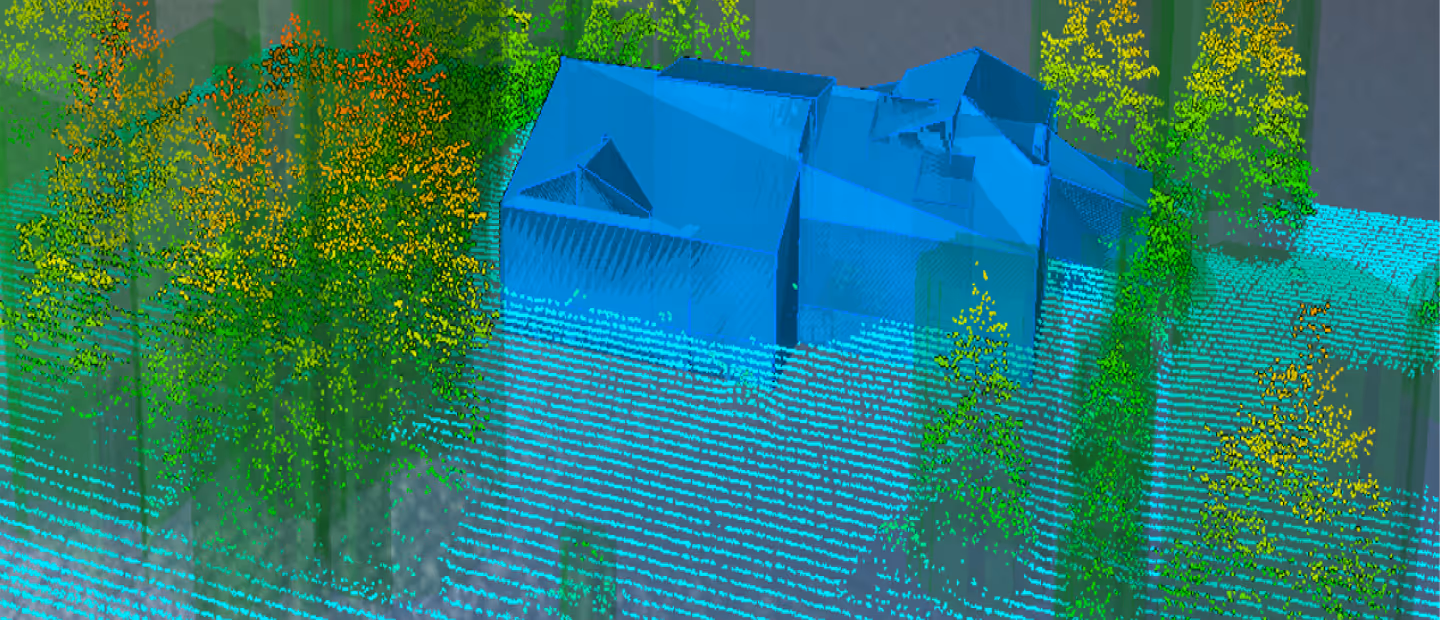
LiDAR and Remote Sensing Analysis
Forsite applies LiDAR, satellite, and drone analytics to map forest conditions, hazards, and operational features with high accuracy.
Mapping blocks, retention, health, burn severity, and forest vigor
Extracting slopes, landform attributes, and linear features (roads/seismic lines)
Supporting predictive ecosystem and cumulative effects mapping
Climate Vulnerability and Carbon Modeling
We evaluate climate risks and carbon outcomes to guide adaptive management and support carbon accounting.
Climate vulnerability assessments for extreme storm events and broader climate stressors (drought, tree species resilience)
Adaptive management strategy development
Carbon modeling for planning, offsets, and sustainability programs
Strategic guidance for climate smart forest operations
Economic & Investment Analysis
We integrate economic considerations into forest planning and valuations to support operational and investment decisions
Timber and land valuations for acquisition/divestiture
Cost and revenue inputs (timber values, haul distances, system costs)
Scenario analysis that optimizes financial and resource outcomes
Log Market Reports
We maximize landowner returns by marketing forest products and providing market intelligence.
Competitive bid marketing to secure optimal pricing
Price negotiation and mill proposal analysis
Quarterly market reporting and trend insights
Key Features and Benefits
Actionable insights for decision-making support and improved outcomes.
Frequently Asked Questions
What data sources does Forsite's analytics work draw on?
Our primary inputs are LiDAR point clouds, multispectral and satellite imagery, ground-based plot data (permanent and temporary sample plots), forest industry GIS datasets including forest inventory and climate data layers. For growth and yield modeling, we also use client-specific measured plot data to build empirical yield curves calibrated to your stands rather than relying solely on regional models.
What growth and yield models does Forsite use?
We apply a range of regional and empirical models depending on jurisdiction, species composition, and management objectives. These include TASS/TIPSY, VDYP, MGM, GYPSY, MIST, FVS, FPS, and SLYM. Model selection depends on your data availability, the planning question you're answering, and regulatory expectations in your jurisdiction. Where regional models don't adequately reflect your stands, we develop empirical yield curves from your own plot data to improve projection accuracy.
How does LiDAR support timber supply analysis?
LiDAR provides high-resolution data on stand structure, volume, and condition that feeds directly into forest estate models and timber supply reviews. We use LiDAR point clouds to derive canopy height, crown density, basal area, and stand-level attributes across large landscapes — inputs that are more consistent and spatially complete than plot-based estimates alone. LiDAR also supports identification of inoperable areas, harvest constraints, and terrain features that affect haul cost modeling.
What is forest estate modeling and when do I need it?
A Forest estate modeling simulates how a forest land base evolves over time under different management strategies. It projects timber harvest levels, species composition, age class distribution, and non-timber values across a planning horizon of 50–200 years. You typically need it when preparing for a timber supply review, evaluating strategic tradeoffs between harvest levels and biodiversity or carbon commitments, or assessing how a proposed change to management practice affects long-term sustainable yield. Forsite uses tools including Patchworks, Woodstock, and Remsoft to build and run these models.
What data is needed to support a timber supply review?
A timber supply review requires a well-defined land base, an up-to-date forest inventory, a calibrated growth and yield model, and a set of management rules that capture harvest constraints, old growth requirements, riparian and wildlife buffers, and any applicable biodiversity targets. Forsite has supported timber supply reviews across multiple areas and can help assemble, QA, and run the analysis from existing data, identify gaps that need to be filled before submission, and prepare scenario outputs that clearly communicate tradeoffs to review panels.
What carbon programs does Forsite support?
Forsite supports carbon modeling and program delivery for offset and sustainability programs including voluntary and compliance markets. Our work covers carbon inventory design, growth and yield projections for baseline and project scenarios, and reporting outputs aligned to program verification requirements. If you are evaluating whether your forest land base is eligible for a carbon program or need modeling to support an existing offset project, our climate and carbon analytics team can scope the work to your specific program and jurisdiction.
Ready to See the Full Picture?
Forsite brings together aerial sensors, geospatial analytics, and on-the-ground expertise — one integrated team, from first acquisition to final decision. Let's talk about what that looks like for your operation.