.svg)
.png)
.svg)
Key Takeaways
- Fuel ID gives fire and forest managers current, validated fuel data built from satellite imagery and LiDAR, replacing outdated photointerpreted inventory-based mapping.
- The solution predicts 56 fuel attributes across canopy, midstory, and surface layers, offering a much more detailed view of wildfire risk and forest structure.
- Fuel ID supports both large-scale and site-specific applications, with product resolutions tailored to operational needs, including 30 m landscape products and 10 m mapping for high-value areas.
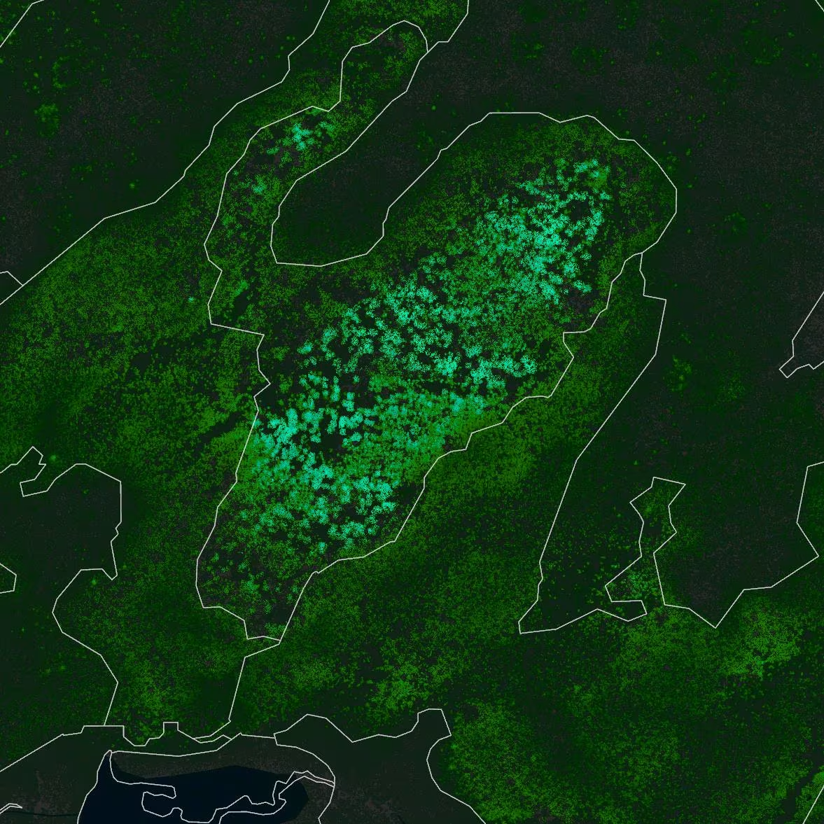
- Coverage already includes all of Alberta through satellite-derived mapping, all of British Columbia for FBP fuel types, and multiple LiDAR-enhanced attribute mapping sites across BC, Alberta, and Ontario.
- The data has practical value across wildfire management, forestry, utilities, mining, Indigenous land stewardship, parks, and municipal planning.
- Fuel ID is designed to scale and evolve as new satellite and LiDAR data become available, making it a continuously updateable platform rather than a static map product.
- Upcoming additions such as grass curing, crop curing, and snow cover estimates will make Fuel ID even more dynamic and useful throughout the fire season.
Intro
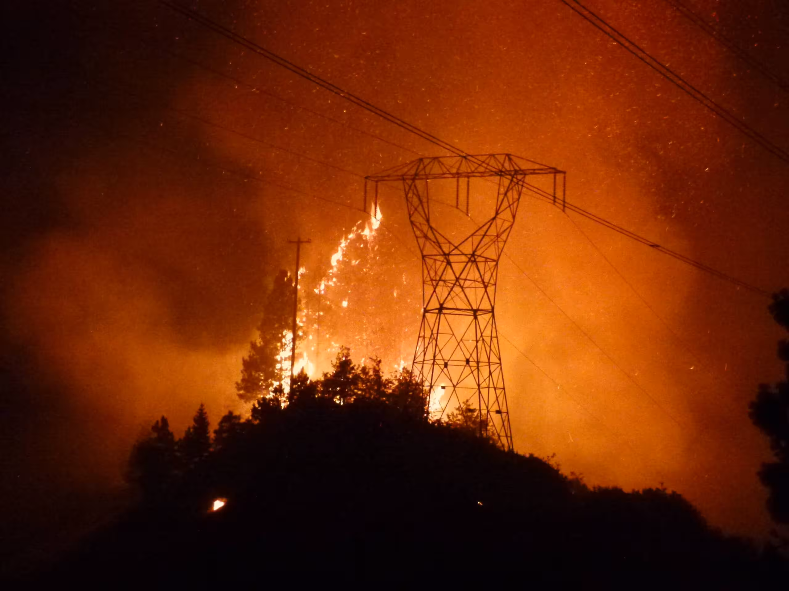
The biggest problem with existing wildfire fuel maps is not simply resolution — it is currency and accuracy. Fuel maps are typically derived from forest inventories, and in many regions those inventories are based on photointerpretation methods that can be decades out of date. In large parts of various provinces, forest inventories are 50 or more years old. That means the fuel maps derived from them are equally outdated, which is a serious liability when those maps are being used to inform wildfire risk decisions.
Photointerpretation also has fundamental limitations when it comes to capturing the structural attributes that matter most for fuel characterization. Accurately measuring understory height, canopy density, or surface fuel loads from aerial photography alone is extremely difficult. As a result, critical fuel attributes are often estimated poorly or not captured at all.
Forsite’s FireView™ solution addresses these challenges directly with Fuel ID. By combining current, freely available satellite imagery with LiDAR data where it exists, Fuel ID delivers fuel maps that are current, accurate, validated, and built at resolutions appropriate for real-world applications.
Even a satellite-only approach provides substantial improvements over outdated photointerpreted datasets. Where LiDAR is available, Fuel ID can go further by measuring structural attributes that have never been available before at operational scale, including understory metrics and surface fuels. Fuel ID is a flexible process that can be adapted to suit a variety of budgets and available data sources, whether that means satellite only, LiDAR only, or satellite plus LiDAR.
Fuel ID currently offers two related product streams. Some fuel attributes are used to develop FBP fuel types, while others support treatment planning, fire behavior modeling using non-Canadian systems, and a range of other applications.
The Challenge: When Fuel Maps Are Decades Behind Reality
Fire managers and forest operators depend on fuel data to assess risk, plan treatments, and respond to active fires. But across much of Canada, the forest inventories underpinning fuel maps were built from photointerpreted aerial surveys, some conducted 50 or more years ago. The forests those maps describe may look nothing like the forests that exist today.
This disconnect is not just a data quality issue. It is an operational and community safety risk. Decisions made using fuel maps that no longer reflect reality can lead to inaccurate fire behavior predictions, poorly targeted treatments, and inadequate emergency response planning.
Two core problems drive this challenge.
First, currency. Satellite data is current and freely available, but forest inventories are not always updated to take advantage of it. Fuel ID bridges this gap by building directly from current satellite imagery, ensuring maps reflect the landscape as it exists today, not as it was photographed decades ago.
Second, structural accuracy. Photointerpreted inventories struggle to capture key fuel structure attributes such as understory height, canopy bulk density, and surface fuel loads with the accuracy needed for reliable fuel characterization. LiDAR overcomes this limitation by directly measuring three-dimensional forest structure, enabling fuel attributes that have never previously been available at operational scale.
“The biggest problem that agencies face is that fuels are developed from forest inventories. Forest inventories have to be current for the fuels to be current. Often they’re not.”
The Solution: Fuel ID
Forsite developed Fuel ID to address these gaps. It is a flexible, scalable approach to generating current, accurate fuel maps using the best available data for each context and budget.
How It Works
Fuel Type Mapping Using Satellite or LiDAR Data
Using freely available satellite imagery, Forsite can develop updated FBP System fuel type maps that reflect current landscape conditions. This approach is scalable, cost-effective, and delivers substantial improvements over outdated photointerpreted datasets, even without LiDAR. Full provincial coverage in Alberta has already been achieved using this method. Where LiDAR data is available, fuel type mapping can be improved even further.
LiDAR-Based Fuel Attribute Prediction and Fuel Type Mapping
Where LiDAR data is available, Fuel ID goes further by using regression models to estimate 56 fuel characteristics across canopy, midstory, and surface fuel layers. These include attributes such as canopy bulk density, crown fuel load, tree height, tree density, and surface fuel components that cannot be reliably derived from photointerpretation. Accuracy (R²) for stand structure and canopy fuel categories generally exceeded 0.5, with many variables exceeding 0.75.
Application-Appropriate Resolution
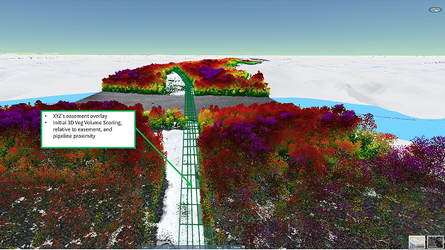
Fuel ID products are developed at resolutions suited to their intended application. Landscape-scale fire management applications use 30 m resolution products, consistent with expert guidance on appropriate FBP fuel type modelling scales. Finer-resolution products, such as 10 m mapping, can be appropriate for assessing small areas adjacent to communities or specific values such as powerline corridors.
Results & Deliverables
Fuel ID has produced current, validated forest fuel type and attribute maps that meaningfully improve on existing provincial and national datasets. Key outcomes include:
- Refined fuel mapping in WUI and urban areas where coarse maps previously failed to capture fine-scale risk
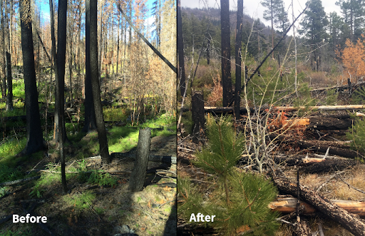
- Identification of regrowth stages in fire scars and post-harvest disturbance areas, supporting monitoring and planning
- More comprehensive fuel structure analysis than the FBP System alone, thanks to 56 predicted attributes instead of broad fuel type categories
- Scalable update capability, allowing the Fuel ID process to incorporate new large-scale LiDAR acquisitions as they become available and keep maps current
FBP fuel types are currently mapped across all of British Columbia at 10 m and all of Alberta at 30 m using satellite-only methods. Three areas in British Columbia, one area in Ontario, and two sites in Alberta have fuel attributes mapped at 10 m. Additional sites in Alberta are currently in development.
Results have already been used to help plan fuel treatment locations in Calgary. Alberta results will also support wildfire risk assessments for utility infrastructure and Alberta RiskView™ clients.
Want to learn how Fuel ID could support your wildfire risk management program?
Talk to a Fuel ID specialist
What’s Next for Fuel ID
Fuel ID continues to evolve as new data sources, methods, and client needs emerge. Upcoming developments include:
- Seasonal grass curing estimates (30 m)
- Dynamic grass curing estimates, currently available at 100 m via RiskView™
- Seasonal crop curing estimates (30 m)
- Dynamic crop curing estimates, currently available at 100 m via RiskView™
- Snow cover estimates, currently available at 100 m via RiskView™
These additions will make Fuel ID an increasingly dynamic platform, responsive to real-world conditions throughout the fire season and beyond.
Who Benefits from Fuel ID?
Fuel ID is applicable wherever accurate, high-resolution fuel data improves decision-making. Current and potential users include:
- Fire management agencies seeking improved operational planning and suppression strategy
- Timber and forest companies needing better fuel condition data to support harvest planning and wildfire risk management
- Utility providers assessing vegetation intrusion risk and wildfire threat to infrastructure corridors
- Mining and resource operators conducting site-level risk assessment in remote and forested environments
- Indigenous governments and communities supporting prescribed fire planning and community wildfire resilience
- Parks and protected area managers responsible for ecological fire management and habitat monitoring
- Municipal and regional governments engaged in WUI planning and community risk assessment
Conclusion
As wildfire risk grows across western Canada and beyond, the quality of fuel data has never mattered more. Forsite’s Fuel ID solution addresses a critical gap in the wildfire management toolkit by delivering the resolution, accuracy, and scalability that modern fire and forest managers need to protect lives, assets, and ecosystems.
By grounding decision-making in current, high-quality data, Fuel ID helps shift wildfire management from reactive to proactive, giving users greater confidence in the information driving their decisions.
Want to learn how Forsite can strengthen your utility's wildfire risk management program?
FAQ
What is Fuel ID and what does it produce?
Fuel ID is Forsite’s LiDAR- and satellite-based fuel mapping solution. It produces current, validated FBP System fuel type maps and, where LiDAR data is available, detailed fuel attribute maps predicting 56 characteristics across canopy, midstory, and surface layers. Products are developed at resolutions appropriate to their intended application, from province-scale satellite-derived maps to finer-resolution corridor-specific products.
How does Fuel ID differ from existing provincial fuel maps?
Existing provincial and national FBP System fuel type maps are often produced using old inventory data, sometimes more than 50 years old, derived from photointerpretation and not validated. Existing maps are also typically available at only a single resolution. Fuel ID maps are developed using current modeled data, with measured and accurate results, and built at an application-appropriate resolution. Fuel ID is also a flexible process that can use a variety of data sources to suit the budgetary needs of different clients.
What industries or sectors can benefit from Fuel ID?
Any organization operating in or near forested landscapes can benefit, including fire management agencies, forestry companies, utilities, mining operators, Indigenous governments, parks agencies, and municipalities. If wildfire risk affects your operations or community, better fuel data supports better decisions.
How current is the data and how often is it updated?
Fuel ID is designed to be continuously updated as new LiDAR acquisitions and satellite imagery become available. Currency is one of Fuel ID’s core strengths because satellite data is freely available and up to date, enabling maps that reflect current landscape conditions rather than decades-old inventories.
Where is Fuel ID currently available?
Fuel ID currently covers British Columbia and Alberta. Data can be accessed through Forsite’s FireView™ and RiskView™ solutions.
Can Fuel ID data be integrated with other wildfire modeling or planning tools?
Yes. Fuel ID maps are designed to work alongside existing fire behavior and risk management workflows. The data can be used to inform wildfire spread modeling, prescribed fire planning, suppression strategy, and long-term landscape management.
.avif)