.svg)
ForestView® — Digital Landscape Intelligence
ForestView® — Digital Forest Intelligence from Tree to Landscape
ForestView® delivers a digital twin of your forest landscape- integrating trees, terrain, roads, streams, biomass, carbon, and growth information into a unified, spatially explicit view. Built from LiDAR, imagery, and field-validated data, ForestView® supports planning, operations, sustainability, and risk-informed decisions. It is outcomes-led and accessible, while providing the technical depth decision-makers expect.

%20(1).avif)
Proven in the Field
Tree-Level Detail and Stand-Level Efficiency
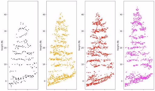
ForestView® combines LiDAR and spectral data, ground plots, and machine learning to deliver enhanced inventories and individual-tree outputs- species, height, diameter, log products -with defensible accuracy reporting and polygon deliverables.
Benefits
Better planning with tree and stand metrics tied to error estimates
Operational visibility for products, growth and yield, and carbon
Flexible tiers: tree-level, enhanced rasters, satellite-derived species, and polygons
outcomes
Operational forest inventories in 21 U.S. states and 9 Canadian provinces
Individual-tree and area-based methods
Government-accepted polygon inventories available
ForestView® and Exchange
Many ForestView® digital products may also be available through Forsite Exchange for access to pre-produced, off-the-shelf datasets. Availability varies by region and product type. Custom ForestView® projects are delivered with professional expertise and tailored analysis.
Let's discuss how Forsite Exchange can support your objectives.
Speak with a Specialist
KEY product FEATURES
What ForestView® Delivers
Inventory building blocks that reduce uncertainty and cost.
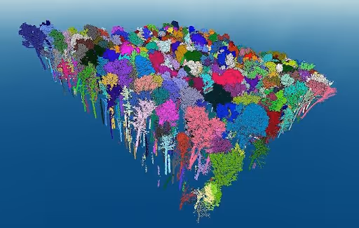
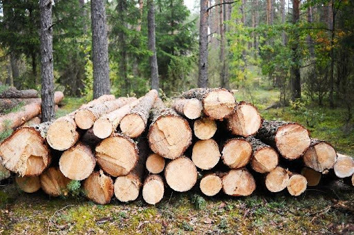
Tree-level attributes including species, height, diameter, volume, and product potential mapped across entire landscapes for operational planning and value assessment.
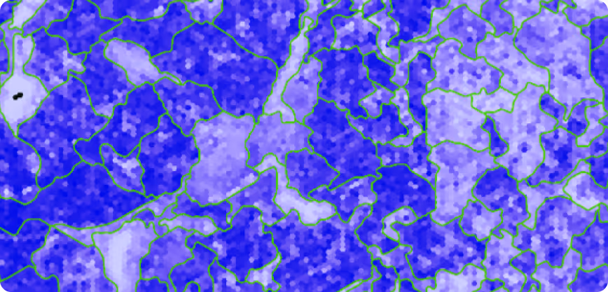
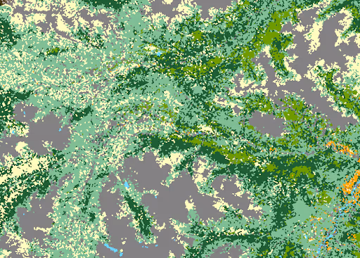
Stand-level attributes derived from LiDAR and imagery, calibrated with ground data, delivered with known error characteristics to support planning and reporting.
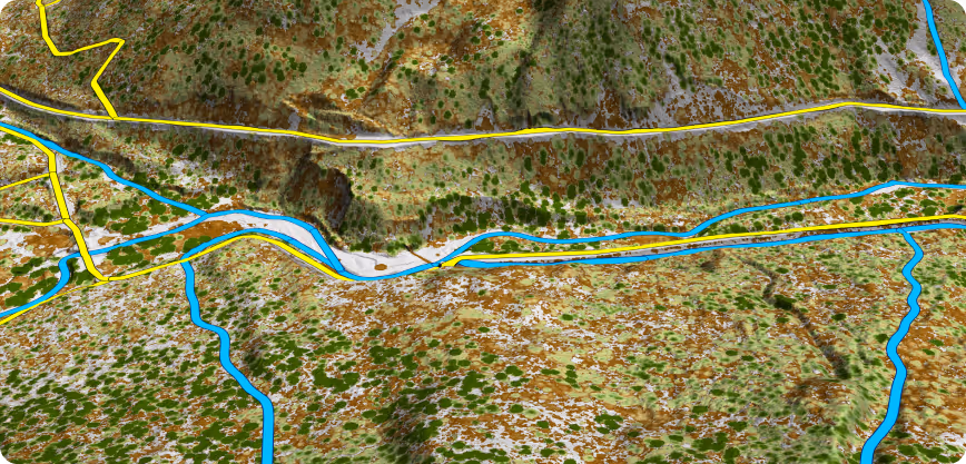
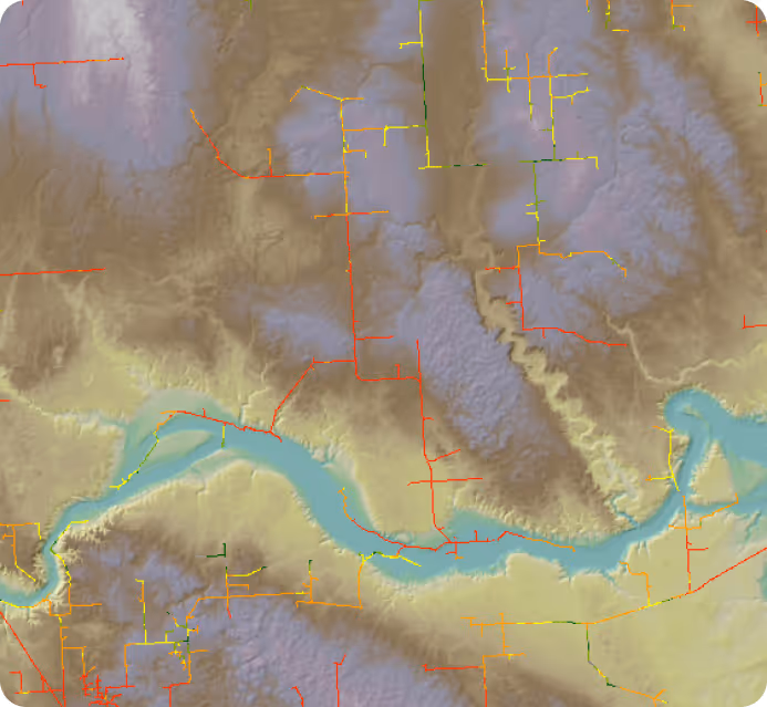
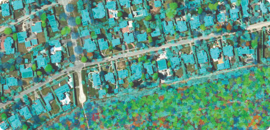
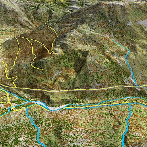
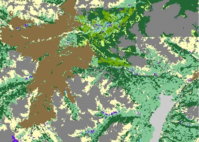
High-resolution terrain models and derived road and stream layers that provide essential context for access, engineering, hydrology, and landscape analysis.
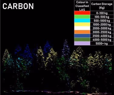
Spatial biomass and carbon estimates aligned to sustainability initiatives, accounting needs, and long-term monitoring.
Inventory outputs structured to support growth and yield modeling, forecasting, and scenario analysis at stand and landscape scales.
Spatial fuel layers describing canopy and surface fuels to support wildfire risk assessment and mitigation planning. Powered by FireView™.
Landscape-scale fire scenario modeling with indicators to support mitigation planning, resource prioritization, and investment decisions. Powered by FireView™.
PRIMARY USE CASES
How ForestView® Is Used
Applications include strategic planning, operational design, sustainability and carbon reporting, landscape risk assessment, and long-term monitoring.
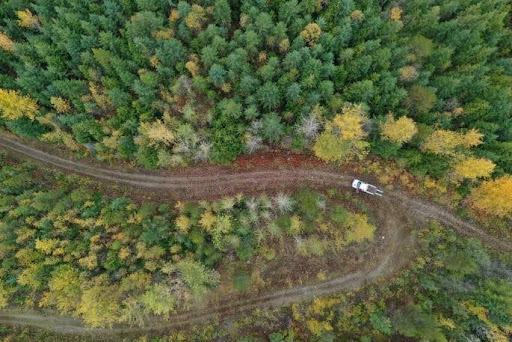
Harvest and Road Design
Tree-level intelligence combined with high resolution terrain data improves layout, safety, cost efficiency, and value recovery.
Individual tree volumes, crowns, and product distributions support precise unit design
Road, stream, and slope layers enhance engineering feasibility and access planning
Fire risk and fuel condition layers inform safer operational timing and layout decision
Timber Supply Modeling
Reliable, accurate tree and stand level data strengthens strategic modeling outputs.
Growth and yield inputs from tree and stand-level data increase model accuracy
Multi-flight LiDAR comparisons quantify height change and productivity over time
Biomass, stocking, and species layers support scenario testing and long-range forecasts
Carbon and Biomass
Strategic forest planning considering carbon storage as a product, with inventory tiers aligned to carbon accounting needs.
Biomass rasters and tree-level carbon estimation from LiDAR-derived attributes
Productivity and height change layers improve forecast results
Regulatory and Reporting
Planning-ready datasets streamline compliance, audits, and stakeholder communication.
Government-accepted polygon inventories with defensible error estimates
Wildlife, water, fuels, and risk layers support multi-resource regulatory reviews
Change detection maps enable monitoring and transparent reporting over time
Frequently Asked Questions
Can we mix methods?
Yes, ForestView® is designed to match budgets and objectives with the right combination of tree-level, stand-level, and polygons.
What accuracy do we get?
Products deliverables include error estimates. Methods are selected to meet target accuracy for the use case.
Is high-resolution LiDAR the same as any LiDAR?
No, LiDAR can be acquired at different resolutions. Publicly available LiDAR is typically coarser and doesn't provide the same level of detail or accuracy.
Is satellite data sufficient to understand vegetation attributes?
Only at very coarse scales — LiDAR combined with imagery is significantly better for measuring vegetation structure and attributes.
Have you completed on-ground validation?
Every project has validation built in from the start so accuracies can be reported (including error estimates). Research level assessments have also been completed for several projects with published results.
Do you collect your own LiDAR? How long does collection and delivery take?
Yes, Forsite collects its own LiDAR. Learn more here.
Timelines range from 1 month to 1 year depending on scale of the project, the terrain and level of analytical products required to meet your needs.
What products will I receive, and do they work in GIS?
Yes, all products are delivered in a format compatible with ArcPro, Qgis, and other GIS software. All products are live and editable. Inventory products are also compatible with MS Access and other database programs to facilitate being imported into G&Y software packages for local projections.
Do you have a fire fuels layer from LiDAR?
Yes, FireViewTM builds on the fuels and forest structure data available in ForestView® and can provide up to 56+ fire fuel characteristics (stand height and density, canopy bulk density, canopy base height, etc.).
.avif)
Ready to Modernise Your Inventory?
We'll configure tiers, accuracy, and budget to your objectives.