.svg)
FireView™
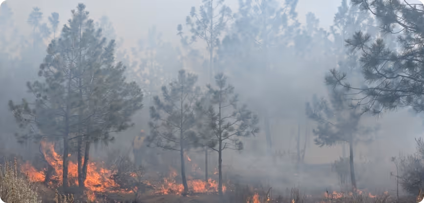
FireView™: Wildfire Intelligence for Planning, Risk, and Operations
FireView™ turns weather data, fuels, terrain, and ignition patterns into wildfire intelligence you can act on. From fire forecasting and burn probability to exposure and scenario modeling, FireView™ provides landscape‑scale analytics that help communities, utilities, and land managers plan, prioritize, and operate with confidence.
.svg)
.png)
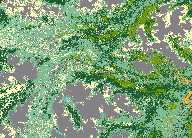
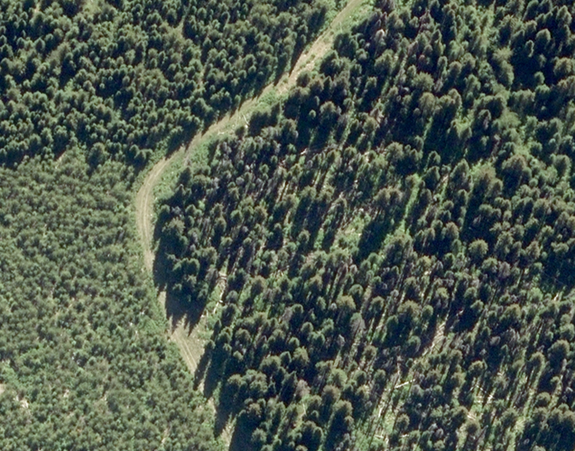
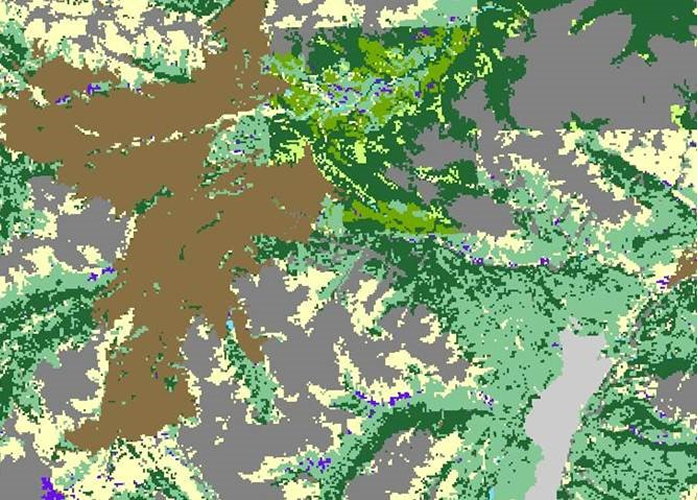
Fuel ID Data and Modeling Workflows
FireView™ leverages the Fuel ID pipeline to derive 56+ canopy, mid-story, and surface fuel characteristics and high-resolution Canadian FBP System Fuel Type maps, then runs behavior models at scale for planning and operations.
Benefits
Higher‑resolution fuels and faster updates
Landscape‑scale simulations (PYroCell, W.I.S.E, Prometheus, BURN‑P3) for scenarios.
Integrated with permitting, resilience planning and operations.
NOTES
56+ fuel characteristics modeled from LiDAR/ satellite.
Built by fire weather/behavior specialists.
KEY product FEATURES
Modular Capabilities — Deploy What You Need Now, Add as Your Program Evolves
From fuels to operations in one toolkit.
Fuel ID vs fuels updates
Fuel ID — full pipeline: 56+ canopy, mid-story, and surface characteristics
Fuels updates — quicker remote-sensing-driven refresh
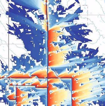
Regionally flexible forecasting engines
Fire spread forecasting based on fuel-wind-moisture inputs
Supports planning, operations, and mitigation design
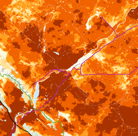
Burn probability modeling prep — seasonality, ignition distributions, fuels, and wind grids
Wildfire modeling — continuous surface
Gridded and Randomized modeling — BurnP3-style ensembles
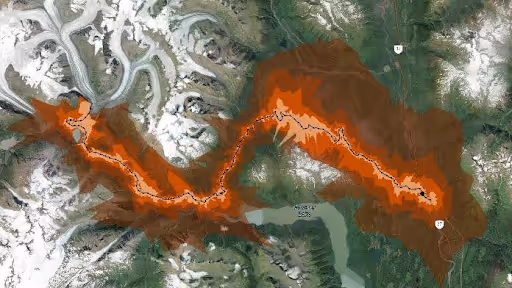
Directional exposure for communities and assets
Building exposure and fireline exposure (FE)
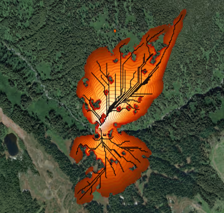
ROS Distance Analysis — time and distance envelopes
Historical weather analysis — wind roses and FWI/ISI roses by season and location
Weather trend analysis — FWI/FFMC trends to reveal changing risk profiles
Reanalysis-grade weather data for consistent comparisons
Ignition threat mapping — kernels or prep-tool
Fire shed mapping
Risk to assets — exposure plus consequence
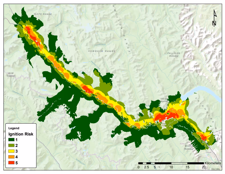
Determine priority management areas for long-term planning.
Scenario comparisons across weather windows
Treatment design and before-and-after deltas
PRIMARY USE CASES
Where FireView™ Delivers Value
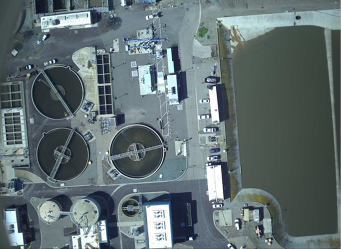
Wildfire Intelligence for Utilities
Daily fuels + behavior feeds for situational awareness.
Forecast path of existing wildfires threatening assets
Current, validated and high-resolution fuels mapping
Identify high-risk areas for new ignitions across your network, based on the current and forecasted weather
Community Resilience Planning
CWRPs and treatment prioritization tied to fuels and behavior.
Priority zones
Evacuation route design
Funding alignment
%201.png)
Industrial Corridors
ROW fire management for critical infrastructure.
Fuels near assets
Mitigation design
Operational playbooks
Permitting and Development
Wildfire hazard assessments and reports for approvals.
Site reviews
Field assessments
District-ready reports
Frequently Asked Questions
What is Fuel ID?
An automated pipeline that creates fuel characteristics and FBP/FBP-NG maps from LiDAR and satellite to support modeling and operations.
Do you support large-scale simulations?
Yes, FireView™ runs Prometheus and BURN-P3 for hazard, burn probability, and spread scenarios.
.avif)
Ready to Reduce Wildfire Risk?
From fuels to forecasts to field-ready plans, our wildfire specialists will align FireView™ to your objectives and operational constraints.