
.svg)
Digital Landscape Intelligence
ForestView® — Digital Forest Inventories from Tree to Landscape
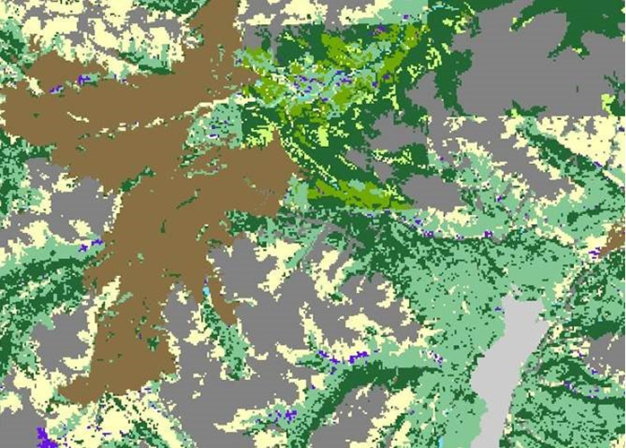
ForestView® delivers a digital twin of your forest landscape — integrating trees, terrain, roads, streams, biomass, carbon, and growth information into a unified, spatially explicit view. Built from LiDAR, imagery, and field-validated data, ForestView® supports planning, operations, sustainability, and risk-informed decisions. It is outcomes-led and accessible, while providing the technical depth decision-makers expect.


%20(1).avif)
Proven in the Field
Tree-Level Detail and Stand-Level Efficiency
ForestView® combines LiDAR and spectral data, ground plots, and machine learning to deliver enhanced inventories and individual-tree outputs — species, height, diameter, log products — with known error estimates and polygon deliverables.
Benefits
Better planning with tree and stand metrics tied to error estimates.
Operational visibility for products, growth and yield, and carbon.
Flexible tiers: enhanced rasters, satellite-derived species, tree-level, and polygons.
outcomes
4M+ hectares analyzed for timber supply modeling
Individual-tree and area-based methods
Government-accepted polygon inventories available
ForestView® and Exchange
Many ForestView® digital products may also be available through Exchange for access to pre-produced, off-the-shelf datasets. Availability varies by region and product type. Custom ForestView® projects are delivered with professional expertise and tailored analysis.
Let's discuss how Exchange can support your objectives.
Talk to an Exchange Specialist
KEY product FEATURES
Modular Capabilities — Deploy What You Need Now, Add as Your Program Evolves
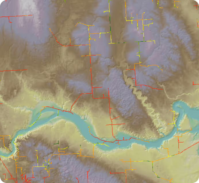
Each capability integrates into a single intelligence platform. Start with patrol and compliance then layer in AI threat detection, leak monitoring, and geohazard monitoring as your program matures.
Fully digital, GIS-based patrol reports replace paper-based processes delivering full fleet visibility across both internal and external patrollers. Forsite integrates enhanced metadata to provide historical and real-time flight logs that support regulatory documentation and audit requirements.
Reduced operational, vegetation, and wildfire risk across your asset portfolio
Compliance-ready data and reporting built to withstand regulatory scrutiny
High-accuracy forest and terrain intelligence via LiDAR, spectral data, and machine learning
Fully digital, GIS-based patrol reports replace paper-based processes delivering full fleet visibility across both internal and external patrollers. Forsite integrates enhanced metadata to provide historical and real-time flight logs that support regulatory documentation and audit requirements.
Reduced operational, vegetation, and wildfire risk across your asset portfolio
Compliance-ready data and reporting built to withstand regulatory scrutiny
High-accuracy forest and terrain intelligence via LiDAR, spectral data, and machine learning
Fully digital, GIS-based patrol reports replace paper-based processes delivering full fleet visibility across both internal and external patrollers. Forsite integrates enhanced metadata to provide historical and real-time flight logs that support regulatory documentation and audit requirements.
Reduced operational, vegetation, and wildfire risk across your asset portfolio
Compliance-ready data and reporting built to withstand regulatory scrutiny
High-accuracy forest and terrain intelligence via LiDAR, spectral data, and machine learning
Fully digital, GIS-based patrol reports replace paper-based processes delivering full fleet visibility across both internal and external patrollers. Forsite integrates enhanced metadata to provide historical and real-time flight logs that support regulatory documentation and audit requirements.
Reduced operational, vegetation, and wildfire risk across your asset portfolio
Compliance-ready data and reporting built to withstand regulatory scrutiny
High-accuracy forest and terrain intelligence via LiDAR, spectral data, and machine learning
Fully digital, GIS-based patrol reports replace paper-based processes delivering full fleet visibility across both internal and external patrollers. Forsite integrates enhanced metadata to provide historical and real-time flight logs that support regulatory documentation and audit requirements.
Reduced operational, vegetation, and wildfire risk across your asset portfolio
Compliance-ready data and reporting built to withstand regulatory scrutiny
High-accuracy forest and terrain intelligence via LiDAR, spectral data, and machine learning
Fully digital, GIS-based patrol reports replace paper-based processes delivering full fleet visibility across both internal and external patrollers. Forsite integrates enhanced metadata to provide historical and real-time flight logs that support regulatory documentation and audit requirements.
Reduced operational, vegetation, and wildfire risk across your asset portfolio
Compliance-ready data and reporting built to withstand regulatory scrutiny
High-accuracy forest and terrain intelligence via LiDAR, spectral data, and machine learning
Fully digital, GIS-based patrol reports replace paper-based processes delivering full fleet visibility across both internal and external patrollers. Forsite integrates enhanced metadata to provide historical and real-time flight logs that support regulatory documentation and audit requirements.
Reduced operational, vegetation, and wildfire risk across your asset portfolio
Compliance-ready data and reporting built to withstand regulatory scrutiny
High-accuracy forest and terrain intelligence via LiDAR, spectral data, and machine learning
Proven in the Field
The Scale to Back It Up
Our operational footprint, technology breadth, and experience create unmatched confidence in planning and risk reduction.
1.8M
sq mi
High-density LiDAR collected across North America
2.2M
Miles per year
DOT pipeline right-of-way patrols conducted annually
1.8M
sq mi
High-density LiDAR collected across North America
56
Fuel characteristics
FireView® fuel-layer modelling attributes for wildfire analytics
100M
hectares
Forest analyzed across North America — ForestView® natural landscape resource inventories and analytics

WHO WE SERVE
Built for the Organizations Who Can't Afford to Get It Wrong
We serve critical infrastructure operators, land managers, government agencies, insurers, and natural-resource industries: organizations where inaccurate data, missed threats, and delayed intelligence carry real consequences.


eyebrow
What We Do
Five integrated service disciplines. One coordinated team.
Pipeline Patrol
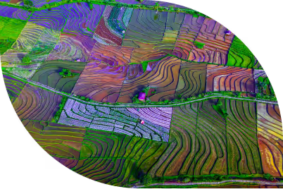
DOT-compliant aerial patrols with Talon360™ oriented imagery. Encroachment detection, compliance documentation, and geohazard monitoring for pipeline and ROW (Right-of-Way) operators.
Learn more
LiDAR & Imagery
High-density and custom airborne LiDAR acquisition, 4-band imagery, and co-collection programs: processed, validated, and delivered in GIS-ready formats.
Learn more
Forestry
Field operations, full-phase silviculture, forest inventory, analytics, strategic planning, and long-term stewardship services across Canada and the US.
Learn more
Wildland Fire
Community wildfire resiliency planning, LiDAR-based fuels mapping, fire behaviour modelling, community wildfire resiliency plan development, and post-fire assessment.
Learn more
Utilities Monitoring
Vegetation analytics, fuel load, species inventory, encroachment risk scoring, and corridor mapping for utility transmission and distribution asset managers.
Learn more
Pipeline Intel
Integrated pipeline patrol, Talon360™ oriented imagery, and LiDAR change detection, structured for compliance and built for rapid anomaly response.
Explore Pipeline Intelligence
ForestView®
LiDAR-powered digital forest inventory products, from individual tree metrics to landscape-level planning intelligence.
Explore ForestView®
FireView®
High-resolution, seasonal fuels intelligence combined with validated wildfire behaviour modelling for communities, utilities, government agencies, and insurers that need to understand fire risk before it arrives.
Explore FireView®
RiskView™
A wildfire risk command center for utility vegetation management teams, combining weather, asset, and vegetation intelligence into a single operational platform.
Explore RiskView™
PRIMARY USE CASES
Where Pipeline Intelligence
Delivers Outsized Value
Lorem ipsum dolor sit amet, consectetur adipiscing elit. Suspendisse varius enim in eros elementum tristique. Duis cursus, mi quis viverra ornare, eros dolor interdum nulla, ut commodo diam libero vitae erat. Aenean faucibus nibh et justo cursus id rutrum lorem imperdiet. Nunc ut sem vitae risus tristique posuere.
Compliance and Audit-Readiness
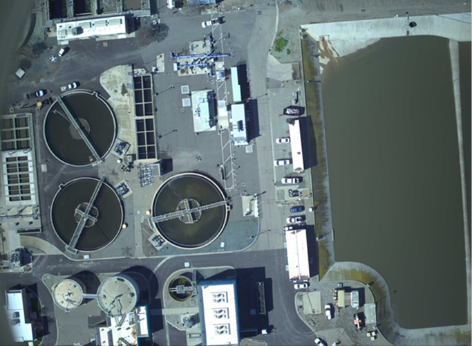
Oriented imagery and digital patrol records provide a traceable, defensible documentation chain for every flight.
Individual tree volumes, crowns, and product distributions support precise unit design
Road, stream, and slope layers enhance engineering feasibility and access planning
Road, stream, and slope layers enhance engineering feasibility and access planning
Compliance and Audit-Readiness
Oriented imagery and digital patrol records provide a traceable, defensible documentation chain for every flight.
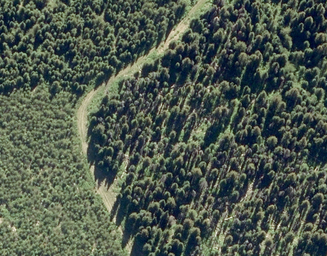
Individual tree volumes, crowns, and product distributions support precise unit design
Road, stream, and slope layers enhance engineering feasibility and access planning
Fire risk and fuel condition layers inform safer operational timing and layout decisions
Compliance and Audit-Readiness
Compliance and Audit-Readiness
Individual tree volumes, crowns, and product distributions support precise unit design
Road, stream, and slope layers enhance engineering feasibility and access planning
3
%201.png)
Compliance and Audit-Readiness
Oriented imagery and digital patrol records provide a traceable, defensible documentation chain for every flight.
feature text
Road, stream, and slope layers enhance engineering feasibility and access planning
Fire risk and fuel condition layers inform safer operational timing and layout decisions
.png)
customers testimonials
What Our Clients Say

Frequently Asked Questions
Question text goes here
Lorem ipsum dolor sit amet, consectetur adipiscing elit, sed do eiusmod tempor incididunt ut labore et dolore magna aliqua. Ut enim ad minim veniam, quis nostrud exercitation ullamco laboris nisi ut aliquip ex ea commodo consequat. Duis aute irure dolor in reprehenderit in voluptate velit esse cillum dolore eu fugiat nulla pariatur.
Question text goes here
Lorem ipsum dolor sit amet, consectetur adipiscing elit, sed do eiusmod tempor incididunt ut labore et dolore magna aliqua. Ut enim ad minim veniam, quis nostrud exercitation ullamco laboris nisi ut aliquip ex ea commodo consequat. Duis aute irure dolor in reprehenderit in voluptate velit esse cillum dolore eu fugiat nulla pariatur.
Question text goes here
Lorem ipsum dolor sit amet, consectetur adipiscing elit, sed do eiusmod tempor incididunt ut labore et dolore magna aliqua. Ut enim ad minim veniam, quis nostrud exercitation ullamco laboris nisi ut aliquip ex ea commodo consequat. Duis aute irure dolor in reprehenderit in voluptate velit esse cillum dolore eu fugiat nulla pariatur.
Intelligence, Applied
Practical guidance from the field: how we think about the problems our clients face and the methods we use to solve them.

.png)
How Dynamic Risk Scoring Changes Operational Decisions
Compliance | How oriented imagery and digital patrol records create a defensible compliance chain — and what DOT auditors look for.
How Dynamic Risk Scoring Changes Operational Decisions
Compliance | How oriented imagery and digital patrol records create a defensible compliance chain — and what DOT auditors look for.
How Dynamic Risk Scoring Changes Operational Decisions
Compliance | How oriented imagery and digital patrol records create a defensible compliance chain — and what DOT auditors look for.
%20(1)%20(1).png)
Ready to See the Full Picture?
Forsite brings together aerial sensors, geospatial analytics, and on-the-ground expertise — one integrated team, from first acquisition to final decision. Let's talk about what that looks like for your operation.